|
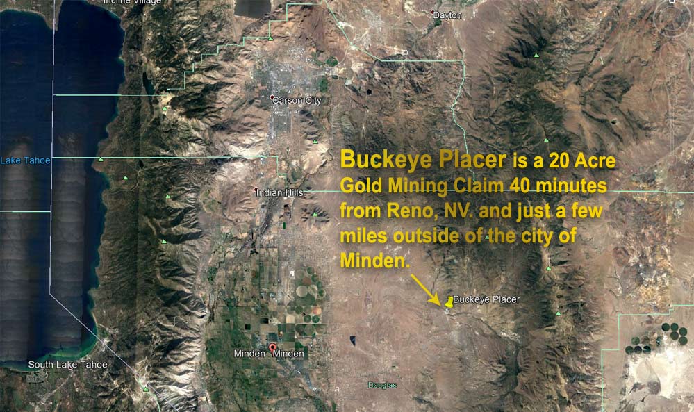
Buckeye Placer
20 Acre Gold Placer Claim for Sale
Buckeye Creek | Mt. Siegel Mining District | Minden | NV.
Mining Commodity: Gold
Past Producer: Yes. 300+ ounces of gold recovered from Buckeye Creek.
Size of Claim: 20 Acres.
Type: Unpatented Placer Mining Claim
State/County: 9 miles east of Minden, Nevada. Douglas County.
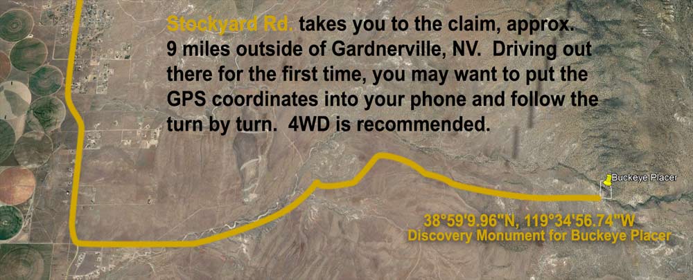
Discovery Monument: 38°59'9.96"N, 119°34'56.74"W
Township & Range: W1/2 SW1/4 SW1/4 T13N R21E S13 Mt. Diablo Meridian
Closest Cities: Minden (9 miles), Carson City (17 miles), Reno (42 miles)
Accessibility: Multiple well maintained dirt roads lead to claim, 2-wheel drive accessible, 4-wheel recommended.
Camping: Yes. This is on BLM land, and a wonderful level camp site exists on the claim with multiple trees for shade.
Food/Amenities: 9 miles away, city of Minden, NV. Gas, food, lodging, hotels, hardware store and casinos.
Cell Phone Reception: Yes. 4G LTE all networks.
Primary Claim Features: Several hundred meters of gold deposits exist on site verified through sampling and BLM records.
Unmined Area: Substantial known quantities. Over 1000' of water frontage on the claim, much of it close to bedrock.
Rock & Deposit Type: Sedimentary Rock > Decomposing Granite > Carbonate > Quartz Monozonite
Comments about Workings: See below.
Buckeye Placer 20 Acre Gold Placer Claim
The Buckeye Placer claim is a gold placer deposit with historic significance, first discovered in 1891, just outside of modern day Minden, Nevada. Thousands of ounces have been minded from Buckeye Creek and the surrounding area. The claim it's self is a good 6 miles outside of town, in a private, beautiful location. Ancient Headwaters has over 1000 feet of creekside to start sampling and mining for gold on. The area is easy to access, and you can pull a camper right up into the claim.
More Buckeye Placer Gold Placer Features:
- Recorded past gold producer. Hundreds of ounces of GOLD have been found in Buckeye Creek
- One of only a handful of available claims along Buckeye Creek
- Seasonal water supply/creek, best in Spring/Early Summer
- Easy year round 2 wheel drive access to the claim. Possible tractor/camper/back-ho/accessible
- Just a few miles outside of all the conveniences and amenities of Minden, NV.
- Over 1000 feet of gold bearing creek water frontage!
- Ideal for small / medium sized mining operations. Accessible from a maintained dirt road.
- Verified gold deposit remains (see sample results below)
Directions to Buckeye Placer
One of the best ways to find the claim is to put the GPS coordinates into your phone:
The GPS Coordinates to the Discovery Monument of Buckeye Placer
38°59'9.96"N, 119°34'56.74"W
All the roads, including the dirts are mapped in Google Maps and other GPS programs. So just punch in those coordinates and you can take the turn by turn directions out there.
Otherwise, here is the general gist of the directions, starting in Reno, NV:
- Merge on to US-395 and head South.
- Continue North on US-395 through Carson City, towards Minden, NV.
- Turn Left of Johnson Ln, for 4 miles.
- Turn right on Freemont St. for 3.5 miles.
- Turn left on Stockyard Rd. It's a dirt road from here on out.
- Stay on Stockyard Rd. alongside the creek as much as possible.
- In approx. 9 miles arrive at at Buckeye Placer, look for the pink discovery monument!
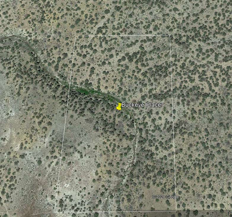
Once you're there, the claim includes 650' north and south of from the discovery monument more or less.
If you have questions on how to locate the claim or you want to sample the claim
prior to making an offer, please send me an eBay message.
Copy of the official location map for Buckeye Placer if you're finding it by section
corners and headings.
Buckeye Placer 20 Acre Gold Placer Claim Photographs
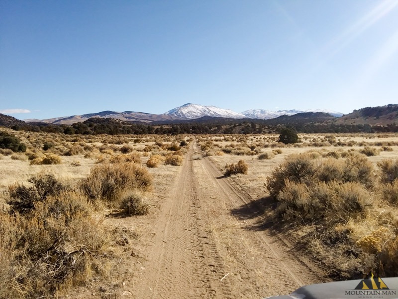
Road head to the Buckeye Placer. Most of the road is easy driving, looks decently maintained
by the county. There are a few parts I'd recommend 4WD for.
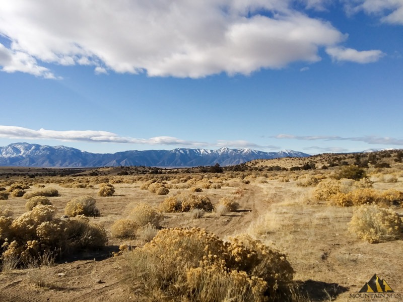
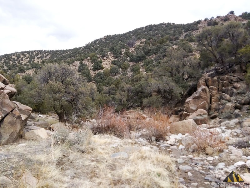
A beautiful view of the surrounding area on the way out to Buckeye Creek to do some mining.
This photo was taken about 1 mile out from the claim boundary.
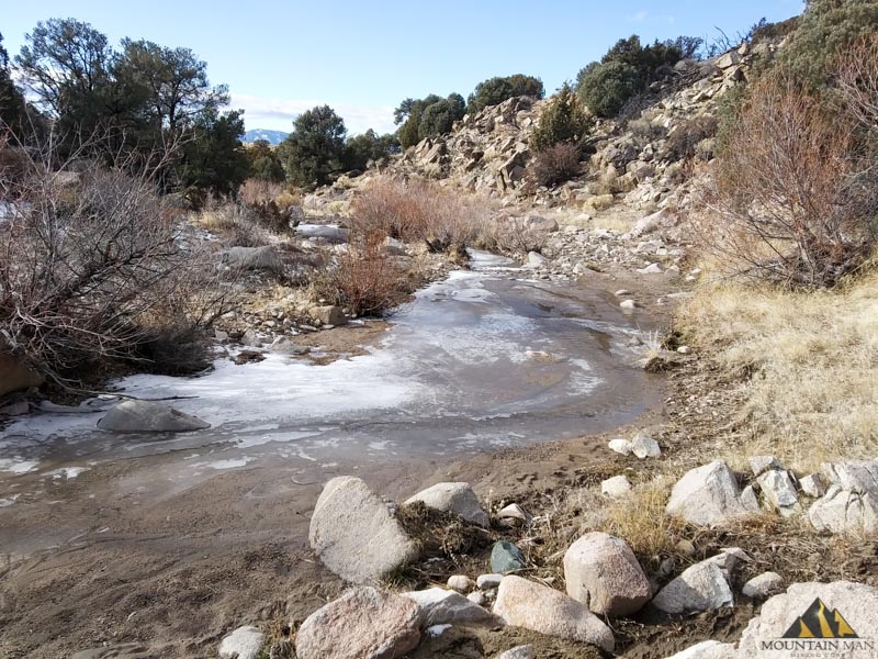
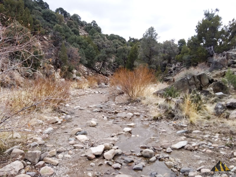
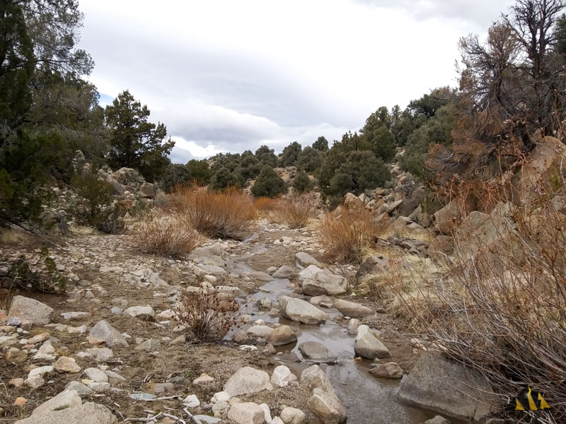
Welcome to the Buckeye Placer gold claim! This is the northern boundary of the claim,
on the creek, looking upstream. Water flows year round this close to the headwaters.
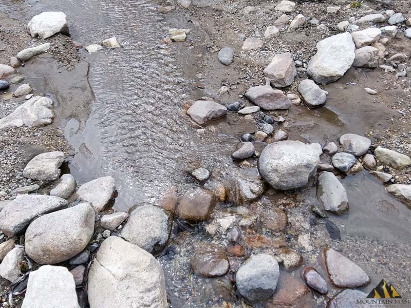
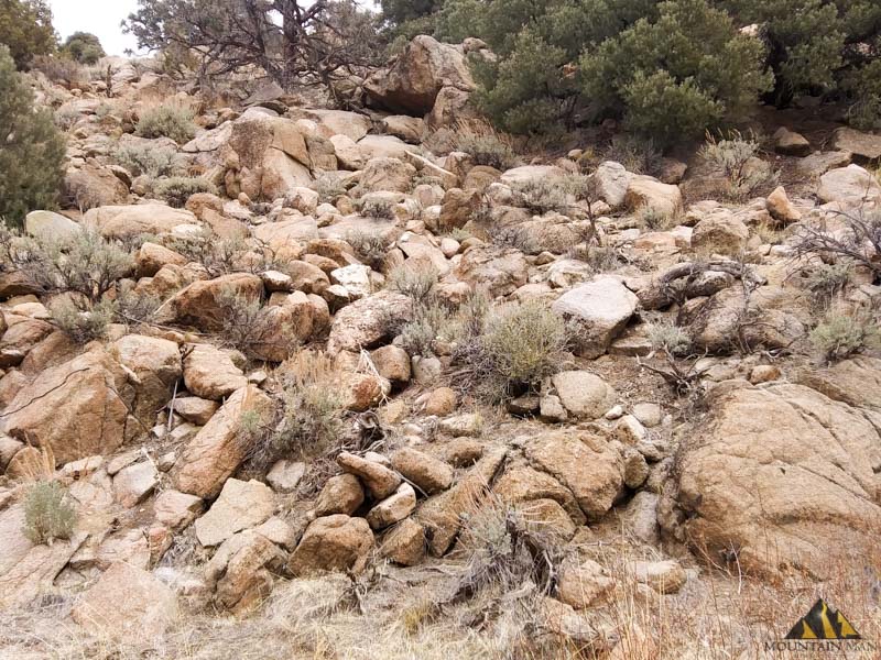
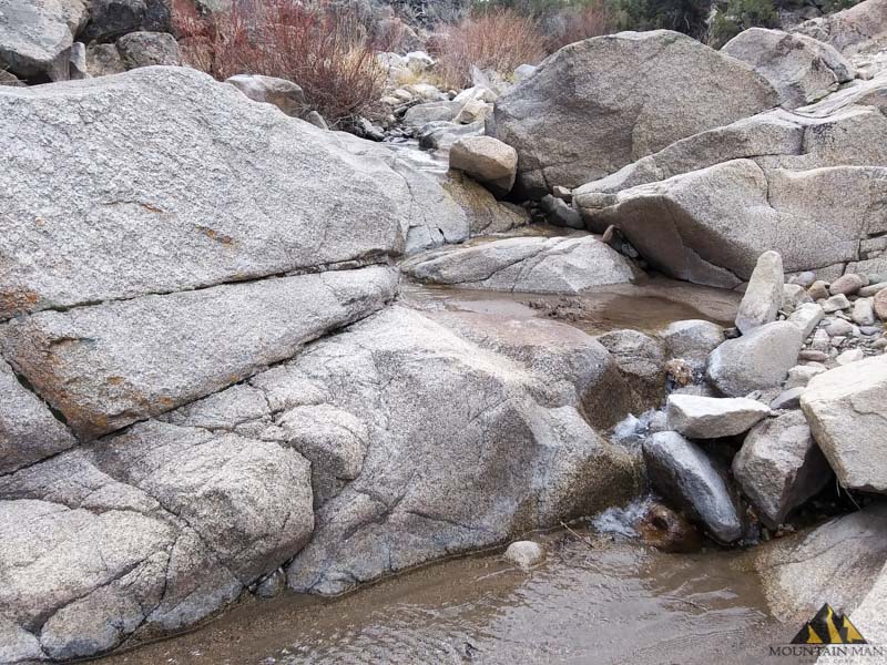
First thing I'm on the lookout for is where the large boulders are settling and if there are
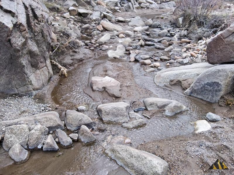
streaks of black sand and/or pyrites glittering on the surface. Here you can see black sands
all through the center channel, and in the top left on the bank.
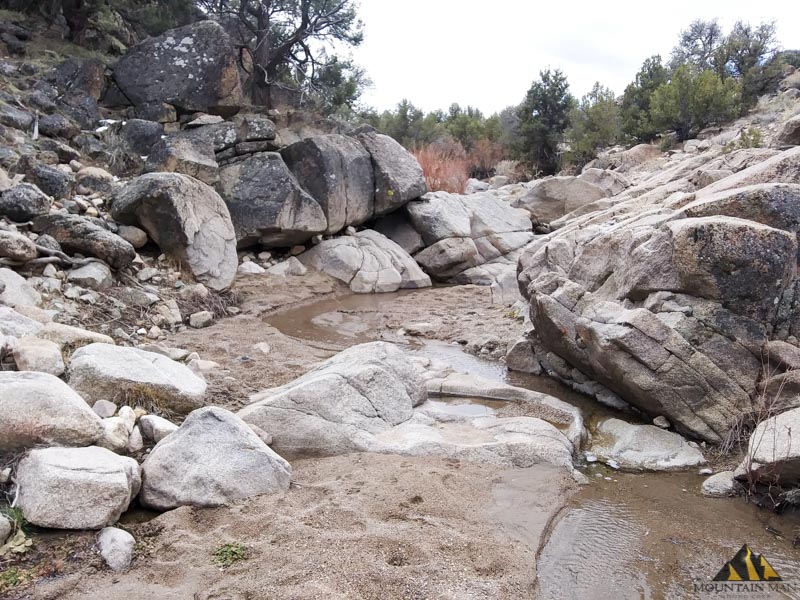
Sandstone and quartz boulders make up the majority of the host rock on either side of the creek.
The official USGS report about the source of the placer gold in the creeks says its from the
decomposing granite, and intrusive quartz monzonite.
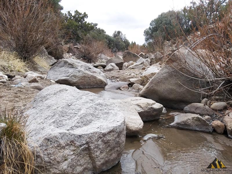
Plenty of large granite boulders have settled in the creek. Heavies like this are great indicators
other heavies, like gold, have settled in the same area.
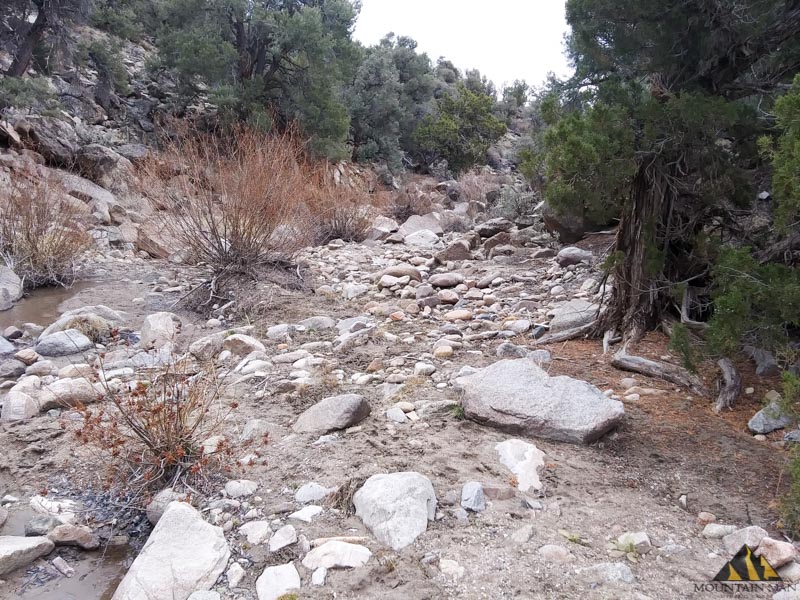
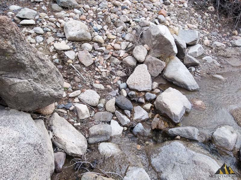
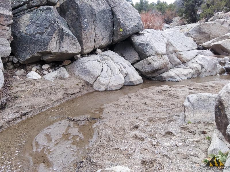
A beautiful high bank full of various, well worn river stones.
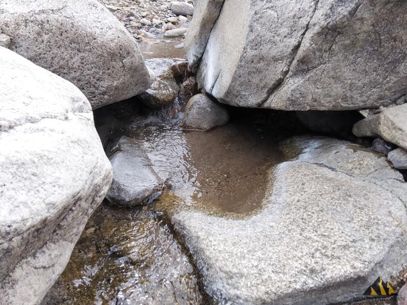
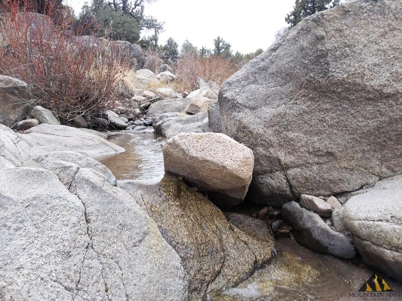
A "Y" in the creek makes a natural low pressure zones for gold to drop.
There are dozens of gold traps on the claim. The water level is low now, which makes the
claim easy to work.
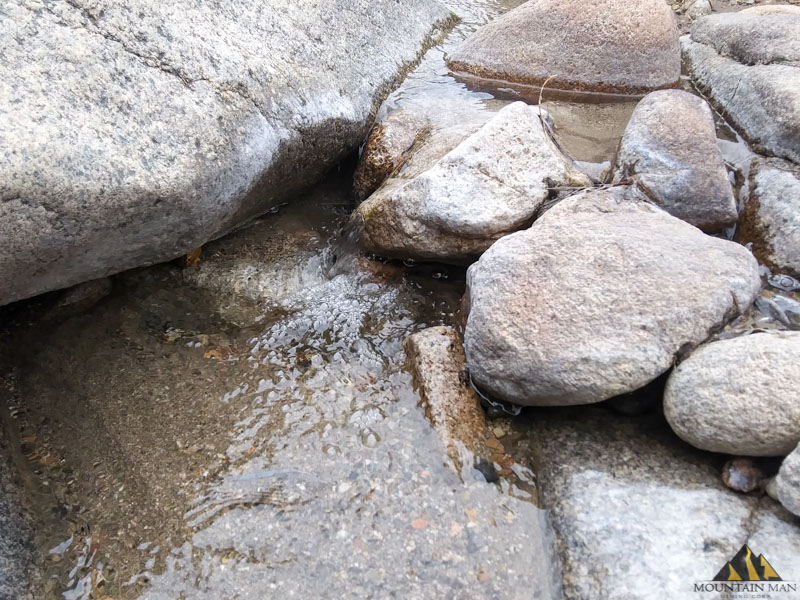
Black sands in the center of the creek surrounded by huge granite boulders.
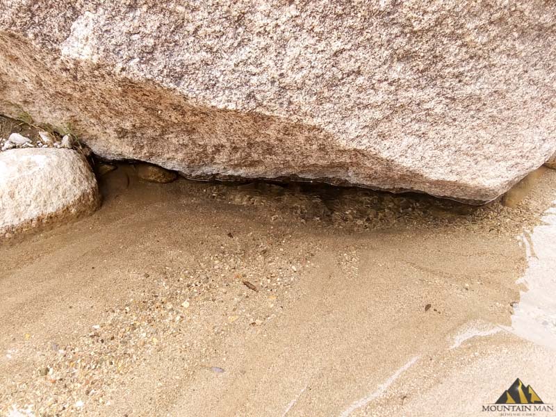
Several inches, almost of foot of heavy gravels and black sands have settled under this
boulder in the creek at the Buckeye Placer.
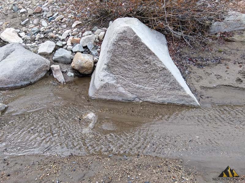
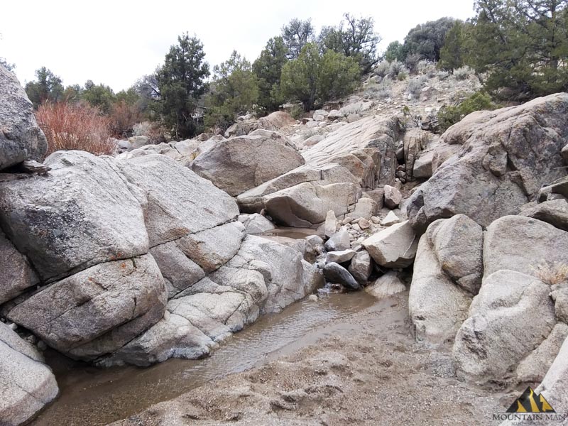
More waterfalls and gold traps. Each 6" waterfall today is a raging gusher during the wet season
creating a possible golden honey hole at the bottom of each one.
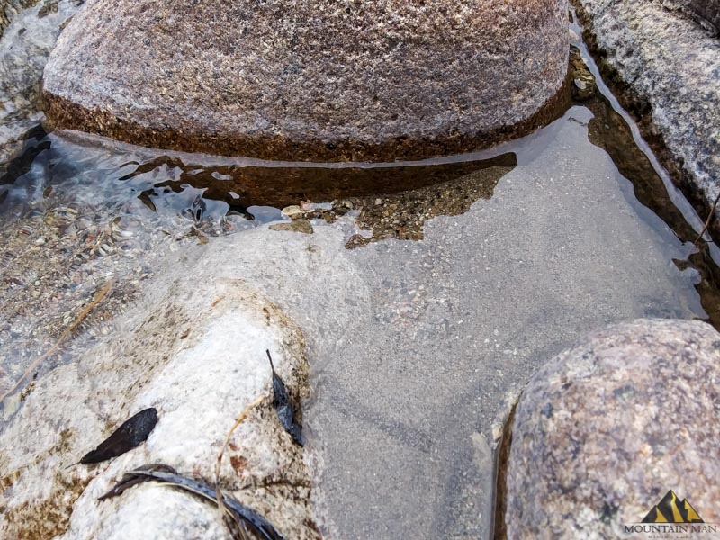
Streaks of bland sand, and pyrite glitter in what little sun was out that day!
Another look at some of the surrounding trees, shrubs and creek-side enviroment.
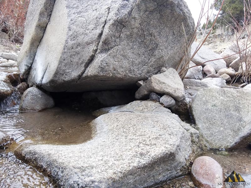
Another pocket of promising looking heavies and gravel at the base of a waterfall.
Some of these boulders are so big, and locked into place, they serve as a false bedrock
in certain places along the creek.
Nice place to build a little dam and put a sluice box eh?
This is one of most featured portions on the Buckeye Placer 20 acres claim. Coming up you'll
see multiple opportunities to crevice along the host rock on either side, and multiple gold
graps in the bend on the creek.
Easily a dozen or more yards of likely gold bearing material right here.
There's gold here, right here, at this exact spot, I can smell it.
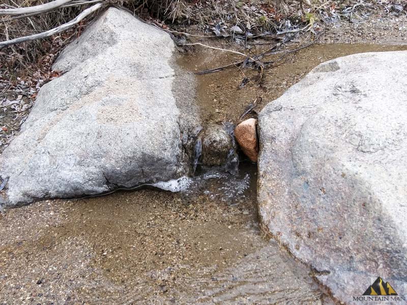
Multi-tiered water fall, with a water level low enough this time of year you can get access
to the gravels at the bottom without hardly even getting wet! Also notice all these
crevices in the granite....
Bottom right you can see a huge pile of black sands at the base of this little waterfall on
top of the granite false bedrock. Might be a great place to start sampling... =D
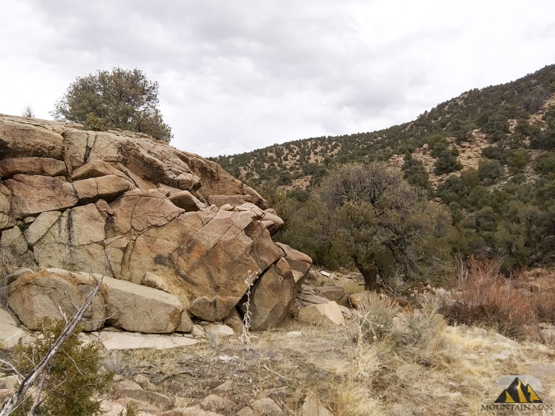
We're coming to the southern most border of the claim boundary, another look around
for perspective. Very beautiful and feels private and isolated.
I saw a "skull" in the rock formation above. Its got the eye socket, and teeth, as
viewed from the side, looking up slightly. Can you see it?
Fitting considering this is the "end" of the claim
and the southeastern corner boundary.
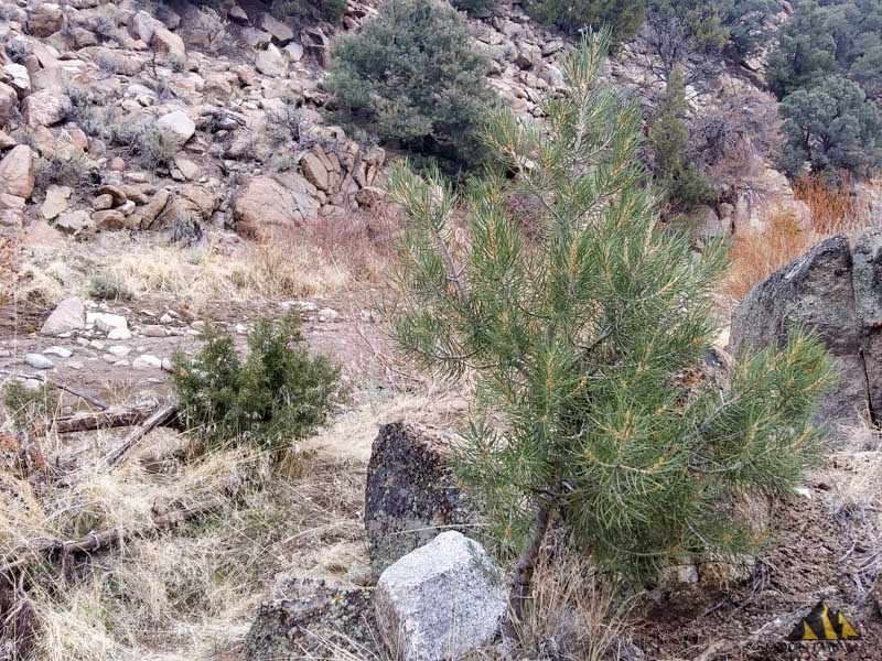
On the way back to the truck, I noticed a sapling sprouting on the Buckeye Placer,
always nice to see new life take root after encountering a giant skull. =D
Finding GOLD at the BUCKEYE PLACER 20 acre placer claim
According to the BLM records this area has only been claimed once since 1976, certainly making much of this claim virgin grounds. You can tell from the lack of fresh tailings piles this area hasn't likel y been worked since it's original discovery back in the 1890's. Regarding the historic gold placers in Buckeye Creek, hundreds of ounces have been recorded:
"Access: From Reno, 45 miles south on U.S. Highway 395 to Minden; from there, dirt roads parallel Buckeye Creek for 20 miles eastward to the Mount Siegel placer area in the Pine Nut Range.
Extent: Placers are Jound on the major headward fork of Buckeye Creek, which drains north along the east side of the crest of the Pine Nut Mountains. The placers consist of unsorted debris composed of rocks, gravels, sands, and some large boulders; the gold occurs throughout the gravels and is both fine and coarse.
Production history: The Mount Siegel placers were discovered in 1891 and worked intermittently to 1943. In 1896 a company spent large sums on pipelines and tunnels to bring water from a small lake to the placers for use in hydraulic mining; lack of water resulted in failure of this operation. In 1896 the King brothers worked placers along bedrock, reportedly recovering $10 per day per man. Placer-mining activity was continuous to 1919. In 1903, 1904, and 1906 about 200 ounces of gold was recovered; in other years, the amount was less than 100 ounces.
Source: The placer gold is a reconcentration of material derived from Tertiary sedimentary rocks in recent gully gravels. No lode source is exposed in the Mount Siegel area; south of Mount Siegel, gold veins are found in quartz monzonite in the Silver Lake (Red Canyon) district. Presumably, erosion of similar veins during the Tertiary was the source of the placer gold that has been reconcentrated in the recent gravels on Buckeye Creek."
- Excerpt from "Placer Deposits in Nevada" by Mareen G. Johson
USGS report from 1976
You can use the newest modern day mining techniques and metal detectors, plus a hundred new years of erosion and deposit formation makes Ancient Headwaters good to mine again. There's gold there, hundreds of ounces or more!
Easy ways to get out there and start mining for gold:
- Dry-washer
- Crevicing along exposed bedrock
- Metal detector for pickers along the ravine
- Sluice box or trommel
- Hand tools and hand gold-panning
- You could even try a dredging! (Dredging is legal in Nevada with a permit)
In my opinion, a dry washer would work wonders for this claim, plus a sluice box. Those two tools, plus something like a Goldcube™ to refine the black sand and cons is all you would need to mine this claim. Work this claim in the early part of the year when there's water guaranteed to be in the creek - and start sampling all along the water frontage till you find a pay-streak, then enjoy mining it out!
About Us, Mountain Man Mining™
We're basically a two man operation, mining hobbyists and small scale miners with a combined 30 years of experience. We do all of our own fire assays and sampling, as well as have access to a mill in Gold Point, NV capable of milling up to 20 tons a day. Still lookin' for the big one.... when we're not mining, or doing our day jobs, we prospect and locate new claims every season. Friendly, positive and ready to help new prospectors and miners, don't hesitate to contact us!
All our placer and lode claims for sale are perfect for small scale and recreational gold miners and prospectors. We located and sold over a dozen claims in 2019. Work with us, and we do all of the work of locating the gold, and legally staking the claim for you - now you get to do the fun part and go out and mine the gold!
How to Buy BUCKEYE PLACER Gold Claim & Make it Yours
The winner of this auction will have the transfer paperwork done for them. Please allow 10 days for the quit claim deed to the drafted and sent to both the BLM and Douglas Co. recorders. All fees are included in the final price of this ad.
A mining claim gives the holder the right to mine on mineral-rich land that belongs to the federal government. Mining claims are a tangible asset and show proof of all interests in minerals in the area. They can be bought, sold or used as collateral, just like any other piece of real estate. A mining claim can be sold, traded, leased, gifted, willed, used as collateral or transferred in part or in its entirety just like any other real property using a quitclaim deed which is a recordable conveyance. Full legal details including resources to the Bureau of Land Management or simply contact us for more details on our quit claim deed process.
Quick 10 Day Transfer & Your Happiness Guaranteed
When you buy purchase this claim I will handle all the paperwork on your behalf with Douglas County as well as the BLM. A quite claim deed will be followed on the claim, at which point the BLM and the county will send you, the new owner, the stamped versions of the newly filed documents marking you as the new claim owner. You should see the claim belonging to you, and ACTIVE in the LR2000 and county recorders office within 2-3 weeks. Please allow up to 10 days after the sale for me to notarize and file the quit claim deeds withe the BLM and Washoe.
If you'd like to visit this claim for a day and sample prior to making an offer or purchasing,
please contact me via the form below to purchase.

|