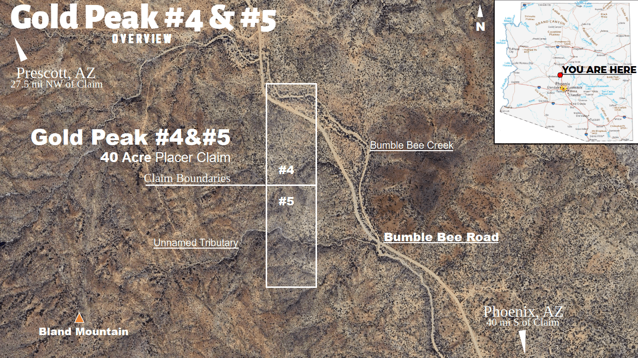
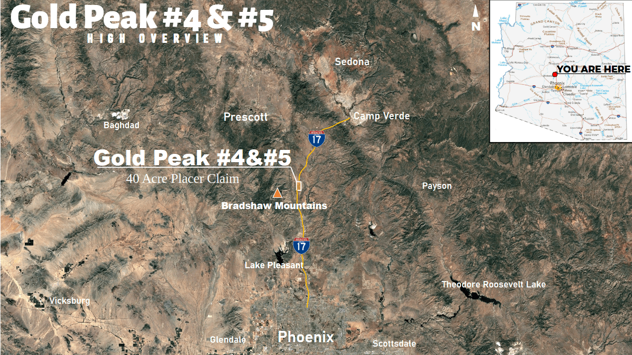
Gold Peak #4 & #5
Find Gold Mere Miles from Phoenix, Arizona!
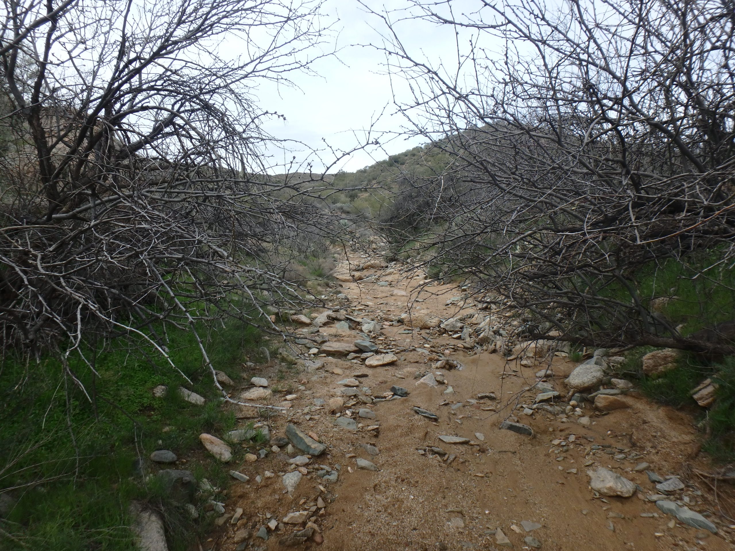
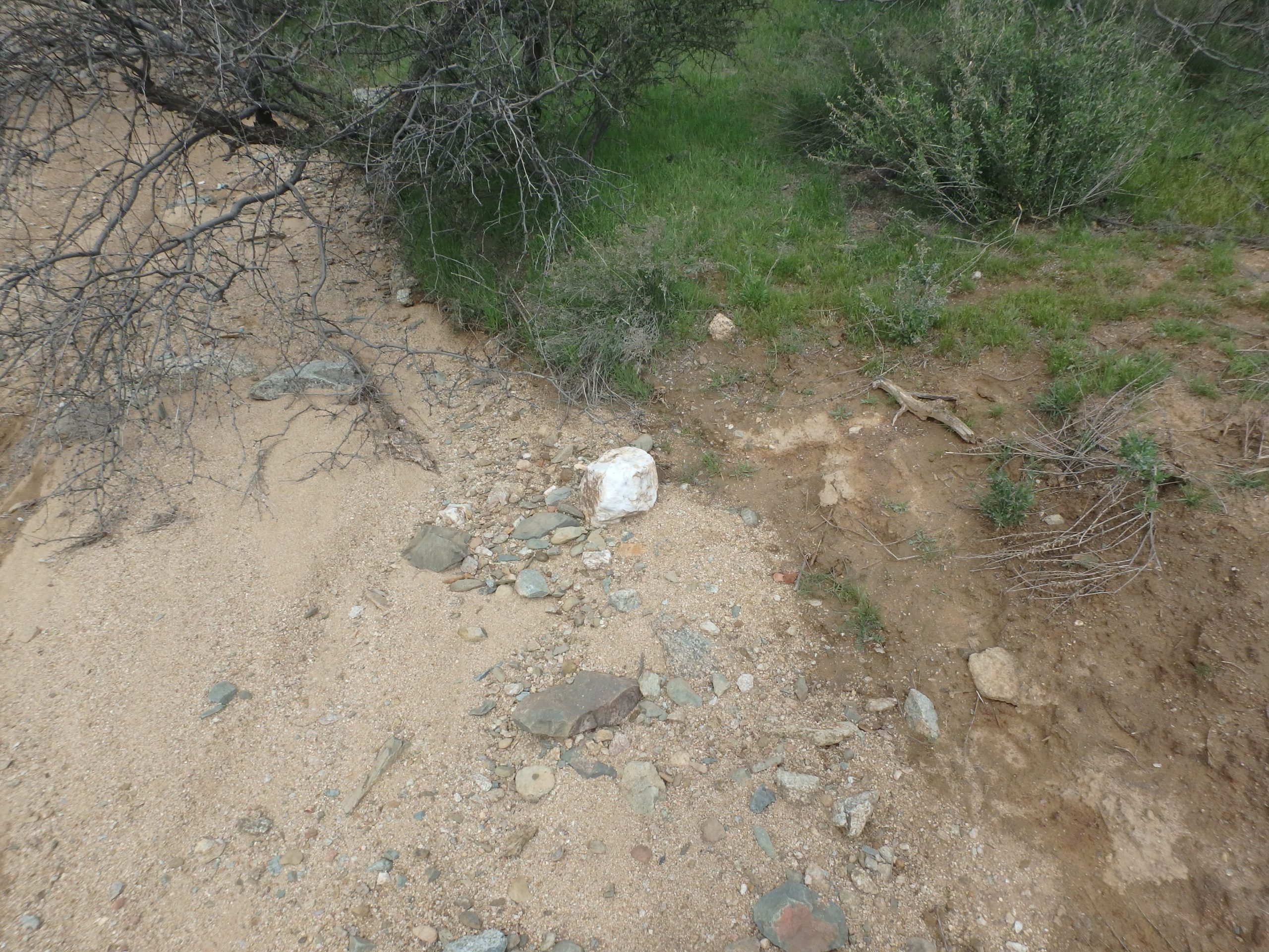
In an area known for the Treasured Trinity - gold, silver, and copper - the Gold Peak claims are aptly named. Placed atop of two rivers full of quartz-rich, fine sands in the Wickenburg Mountains, these claims are the perfect spots to start dipping your pan into and finding fine gold flakes and nuggets. What's more, the rivers have already carved out sections out of the mountain, revealing the beauty and riches that lie below the surface - a work-free way of seeing and sampling the rich mountains of your claims!
The rivers hint at the large quartz deposits hidden underneath and atop these hills, but the source of the Treasured Trinity flowing and working themselves off the mountainside with every rain has yet to be discovered. Looking for light, silica-dense areas or scraping the surface to reveal new quartz outcroppings can put you onto the source of the gold that is flowing into these streams every year!
Forty miles from the center of Phoenix and next to a paved road, the claims couldn't be any closer or easier to get to for Phoenix natives. Even outsiders to the State need not go far into the desert to discover how close the gold really is! With the primary stream being not more than 100 feet from the road, even those with limited mobility can easily have fun getting dirty looking for man's most coveted resource.
Here are the features of the "Gold Peak 4 & 5" claims at a glance:
- Chunky Quartz - Easy to see, chunky quartz provides the perfect starting point for unlocking trapped gold from their mineral matrixes and finding more right behind it! Large quartz boulders hint at larger, undiscovered outcroppings - ore that's perfect for a stamp mill!
- Fine Sands - Plenty of fine sands created from the continued, yearly run-off from the Wickenburg mountains make excellent places to pan and shake for the Treasured Trinity!
- High Point - Located at the source, these claims capture all the gold running off this section of mountain range before they float down the Black Canyon to never be seen again!
- Historical Gold Territory - Lots of golden and silvery history surround the Gold Peak claims in the Black Canyon Mining District; from the Bland Prospect deposit it chases to the American Gulch it creates, or the rich Howard Silver and Cutter claims off the Bradshaw Mountains to the East, gold is found here.
- High Accessibility - With the river bed of the Bumble Bee River found right next to Bumble Bee Road, Gold Peak #4 is flat and easy to work. No four-wheeled vehicle required - just drive up and start panning!
- Variable Experience - While Gold Peak #4 is rather flat, Gold Peak #5 tackles collecting gold where its more hilly and mountainous. Choose your own adventure and find gold by combing the mountainsides or shaking the dry river!
- Close to Town - A mere 40 miles away from the center of Phoenix, driving to your new claims takes less than an hour!
If you're interested in purchasing these gold claims for sale,
please email me here.
 Gold Peak #4 & #5 Main Features
| Type of Claim | Unpatented Placers; AZ101571408, AZ101571409 |
|---|---|
| Size of Claim | 40 ACRES |
| Mining Commodities | Gold, Silver, Copper, Lead |
| Accessibility | Paved Road - Sedan Accessible |
| Closest City | Bumble Bee, Arizona |
| Camping | Yes. Up to 14 days at a time |
| Prior Workings | Little to None |
| Cell Phone Reception | Some Bars on Most Networks |
| Type of Deposit | Placer |
Claim Boundaries, Location Map and GPS Coordinates
The Four Corners: |
Gold Peak #4:
|
Link to Map |
|---|
Download the Google Earth KMZ of "Gold Peak Claims" Boundaries
Gold Peak #4 & #5 Photographs


Economic information about the deposit and operations
| Operation type | Placer |
|---|---|
| Development status | Prospect |
| Commodity type | Gold, Silver, Copper, Lead |
| Deposit size | Unknown |
Mining district
| District Name | Black Canyon Mining District, Yavapai County |
|---|---|
| Deposit MAS/MILS ID | MRDS #10161590 |
Geologic Structures
| Type of Structure | Early Proterozoic Granitic Rocks | ||
|---|---|---|---|
| Structure Description |
|
Gold Peak #4 & #5
Mineral Rights Transfer Process
A mining claim gives the holder the right to mine on mineral-rich land that belongs to the federal government. Mining claims are a tangible asset and show proof of all interests in minerals in the area. They can be bought, sold or used as collateral, just like any other piece of real estate.
A mining claim can be sold, traded, leased, gifted, willed, used as collateral or transferred in part or in its entirety just like any other real property using a quitclaim deed which is a recordable conveyance. Questions about the transfer process can be answered by contacting us anytime. All fees and paperwork current and assessment fees are paid through Sept. 1st 2026.
Purchasing
"GOLD PEAK #4 & #5"
Cash Price
Full mineral rights transfer for "Gold Peak #4 & #5" 40 Acre Placer Mining Claim
Official certificates of location, claim locations and digital maps
Email based support for claim maintenance and questions
Need help purchasing this unpatented mining claim for sale?
Email me for more information and additional payment options.
- After your purchase is complete you will be requested to fill out our new claim owner form with your name/address or add any additional claimants you want on the claim.
- You'll get digital copies of your COL and Map of Location in to your claim(s) will be delivered via email via PDF format as well as Google Earth™ KMZ map file with your claims discovery, corners and points of interest.
- We handle all the filing and transfer services on your behalf. Expect to get official stamped/recorded copies of your paperwork mailed to you from the Yavapai County Recorder's Office and the Arizona Bureau of Land Management officiating you as the new claimant within 10 days of purchase. Then officially enjoy mining gold on your own land!