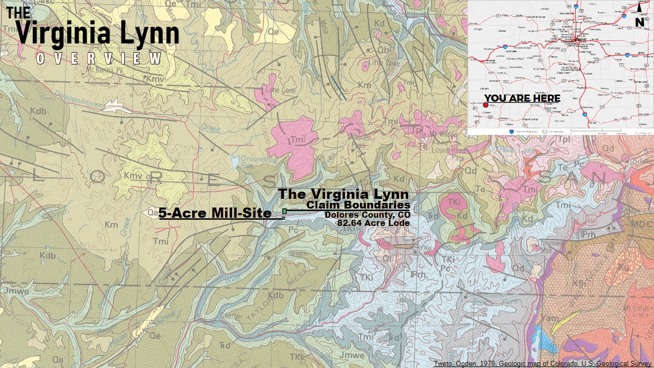
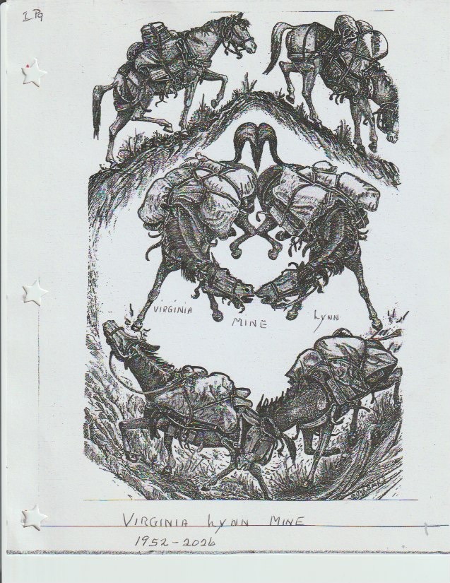
The Virginia Lynn
Unpatented Lode Mine & Mill-Site · 87.64 Acres
Copper Gulch · Dolores County · Colorado · San Juan National Forest
“A proven polymetallic copper-silver-gold lode mine with platinum group elements, existing underground workings, a 70+ year documented history, and ore that has already been shipped to smelter… What could be better than the Virginia Lynn?”
Mountain Man Mining™ · Featured Listing
Overview
Historic Lode Mine Privately Held for Decades, Finally Released to the Public
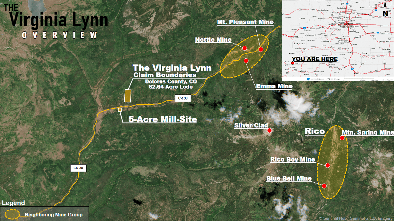
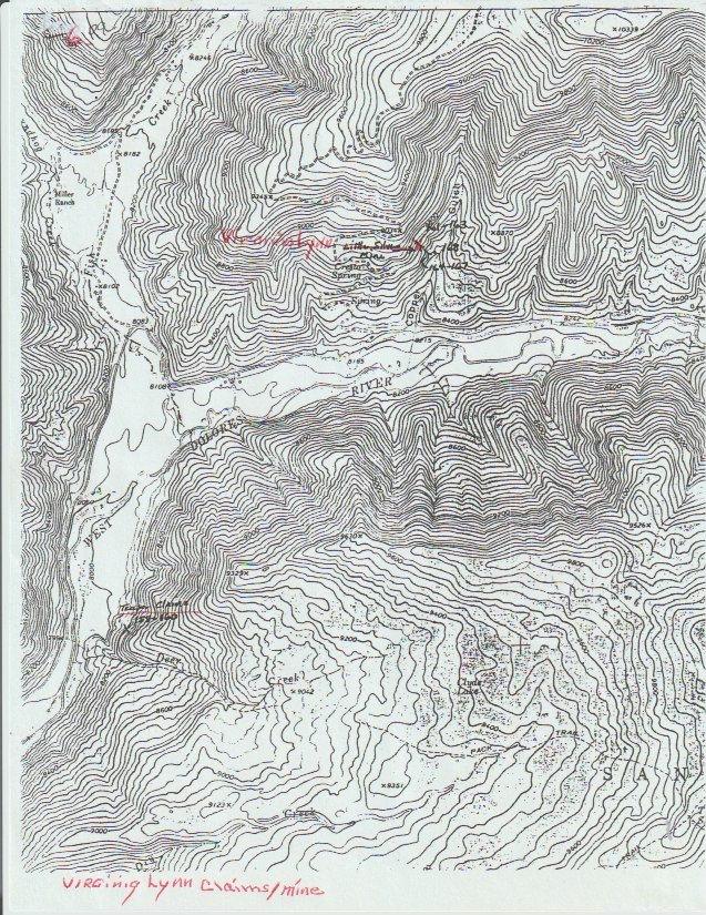
Tucked in the timbered slopes of Copper Gulch on the south side of the Willow Divide in Dolores County, Colorado, the former Little Silver Mine — an 82.64-acre lode mine with a 5-acre mill-site — now known as the Virginia Lynn, sits on a rare spot on the planet.
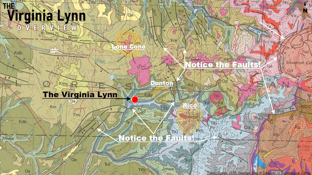
The claims find themselves centrally located on an extensive fault network in the San Juan Mountains, created from the clash of the intrusive San Juan Volcanic Fields and the pre-existing Mesozoic/Paleozoic rock structures. This fault network hosts some of the highest-grade copper deposits found in recent history. Silver is found in commercial quantity, and gold is sprinkled within.
Uninterested in commercially developing the property themselves, the owners have decided to open this well-guarded gem for public sale, in hopes of seeing the legacy of this centuries-old mine be carried on.
History
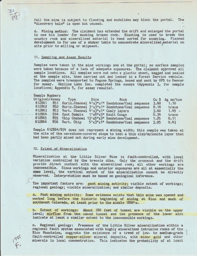
A Centuries-Old Historical Mine
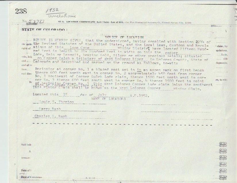
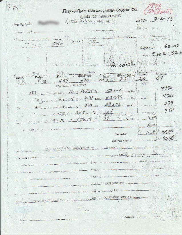
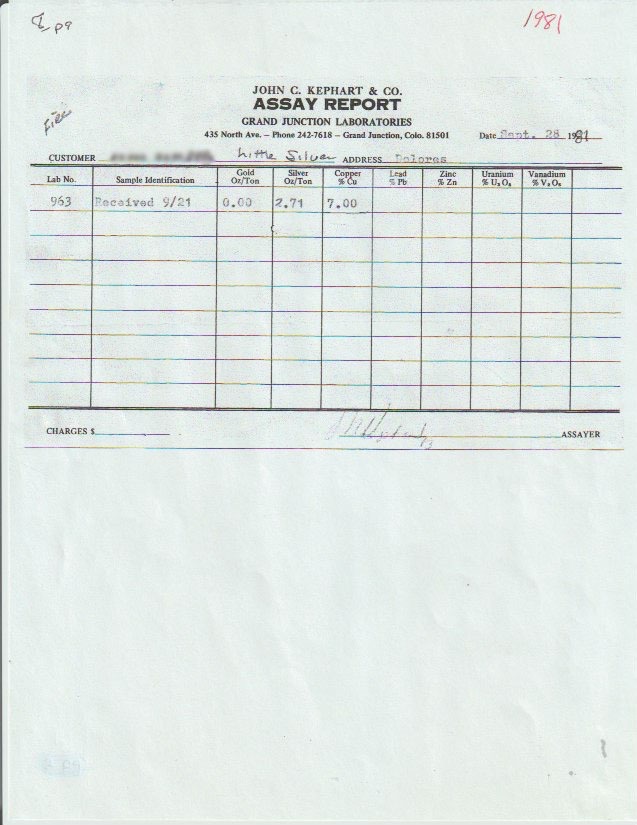
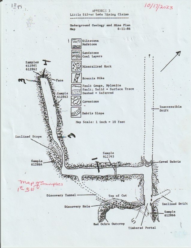
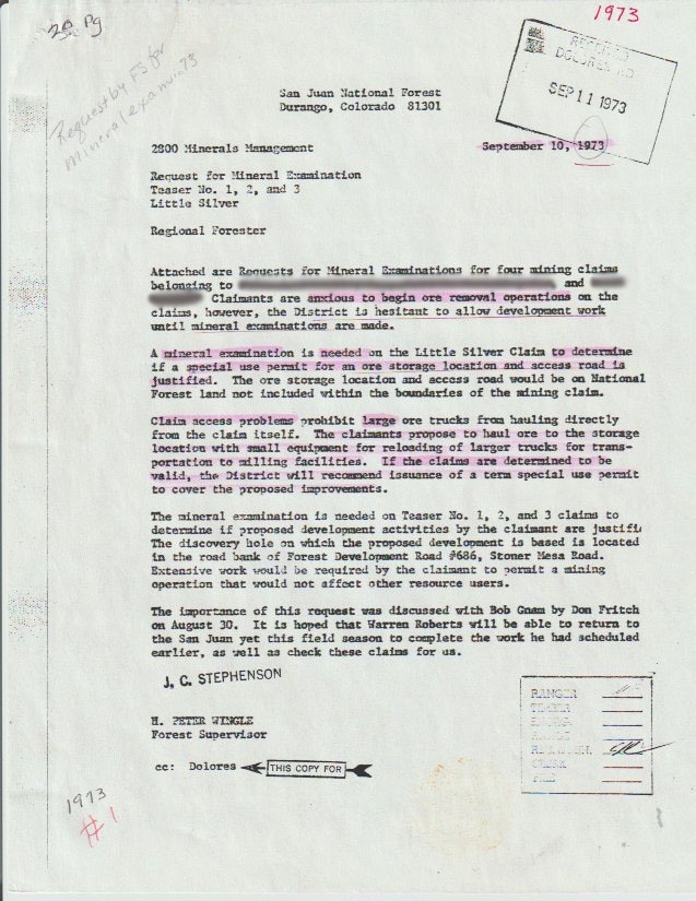
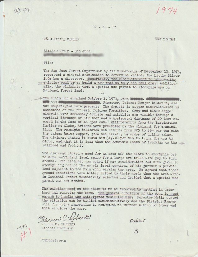
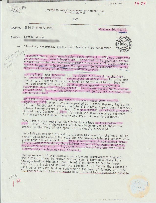
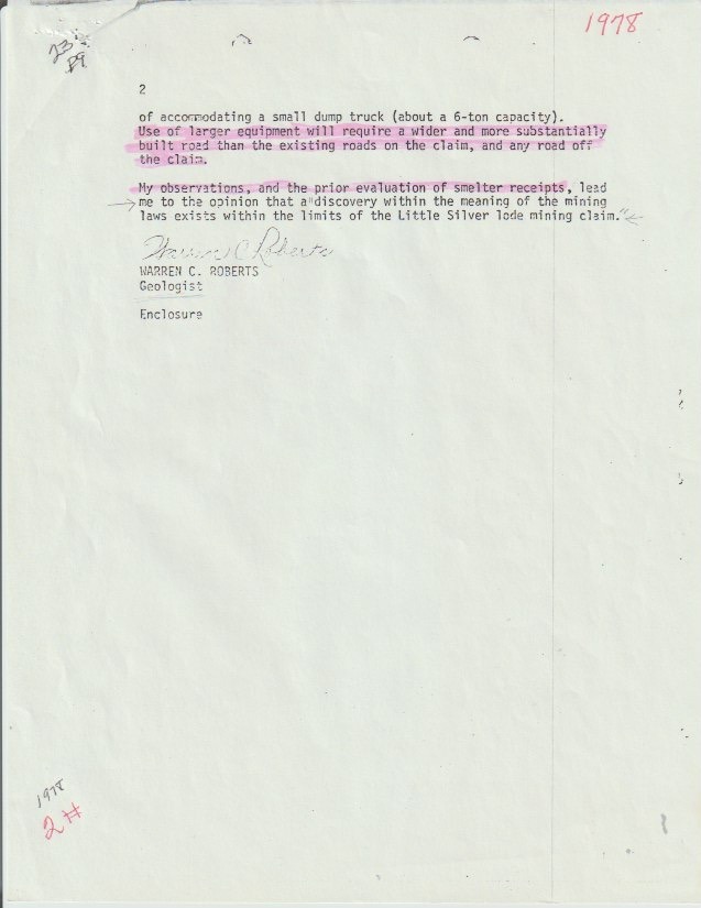
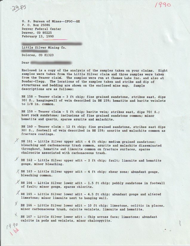
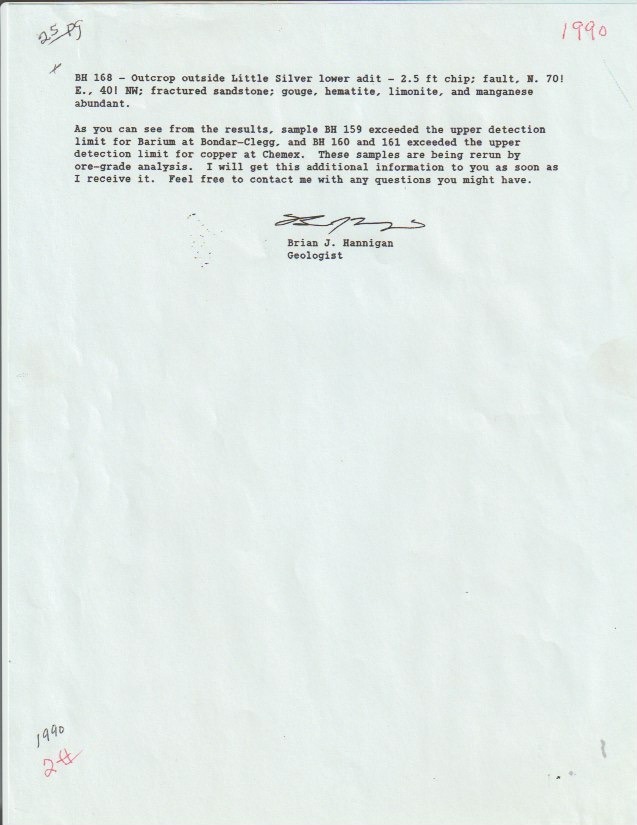
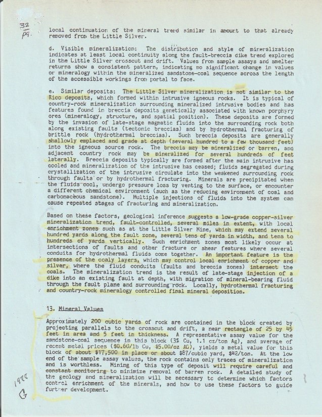
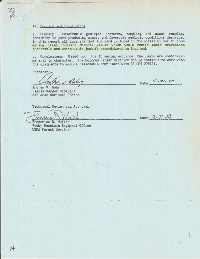
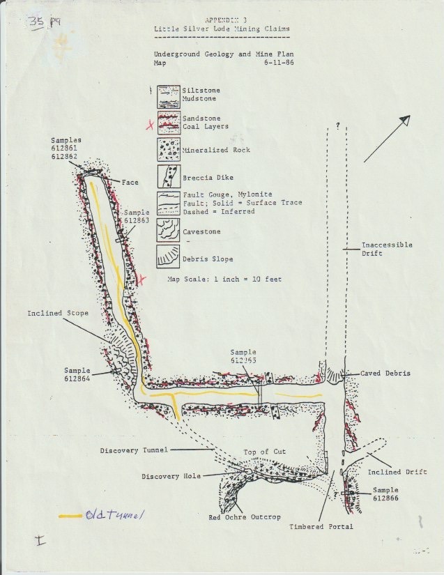
With over 70 years of recent, well-recorded history, the Virginia Lynn claims have been formally examined by the U.S. Forest Service and the Bureau of Mines on multiple occasions — in 1973, 1977, 1988, and 1990 — each time confirming the presence of valuable copper-silver mineralization. The 1988 Forest Service Mineral Report concluded that the land contains mineral values sufficient to justify extraction.
Federal examinations identified other key minerals: platinum, palladium, titanium, and consistently high amounts of barium. There is also evidence the mine was worked long before the historic mining boom at nearby Rico, possibly as early as the mid-1800s.

“Observable geologic features, sampling and assay results, proximity to past producing mines, and favorable geologic conditions all indicate that the land contains mineral values which would render their extraction profitable.”
Andrew G. Raby, USDA Forest Service Mineral Report, 1988
Interested in the Virginia Lynn?
Our team answers every inquiry personally — usually same-day. Ask about site visits, financing, or make an offer.
Geology
Mineral Structure
The Virginia Lynn claim group lies near the Rico Mountains intrusive complex, at the center of an extensive fault system on the Willow Divide with subparallel and continuous faults radiating 20 to 30 miles East and West. This same intrusive complex powered the legendary Rico and Lone Cone mining districts — the Virginia Lynn is directly connected to the same mineralizing system.
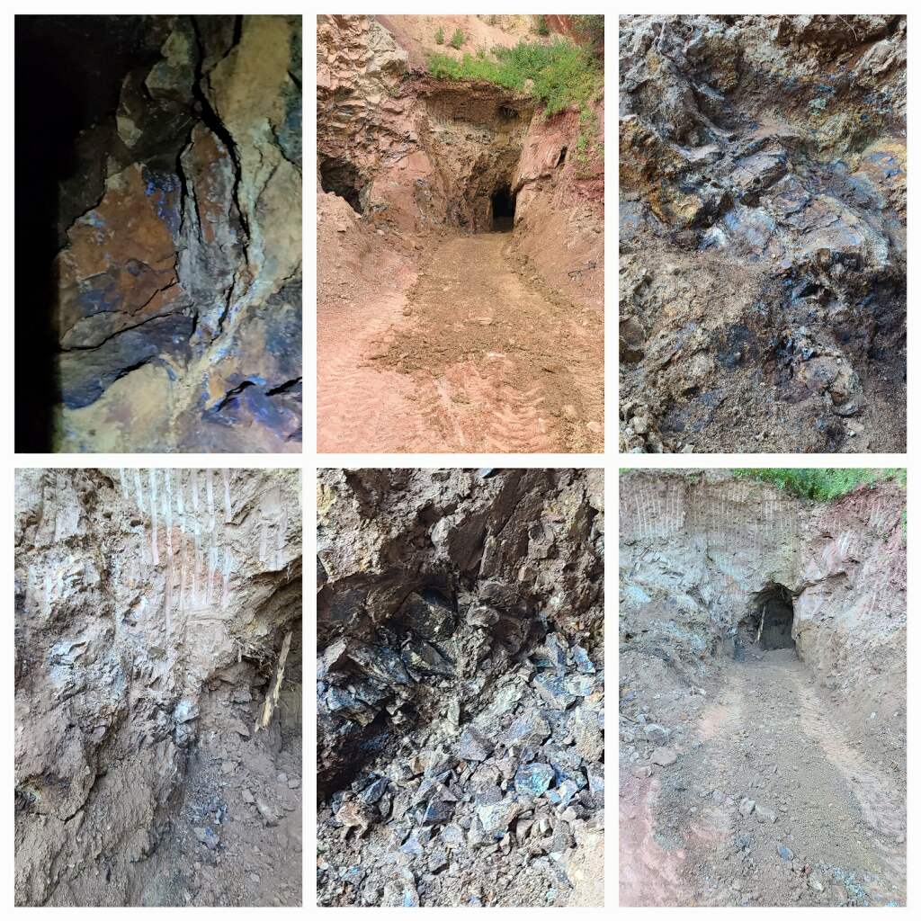
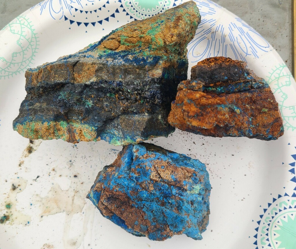
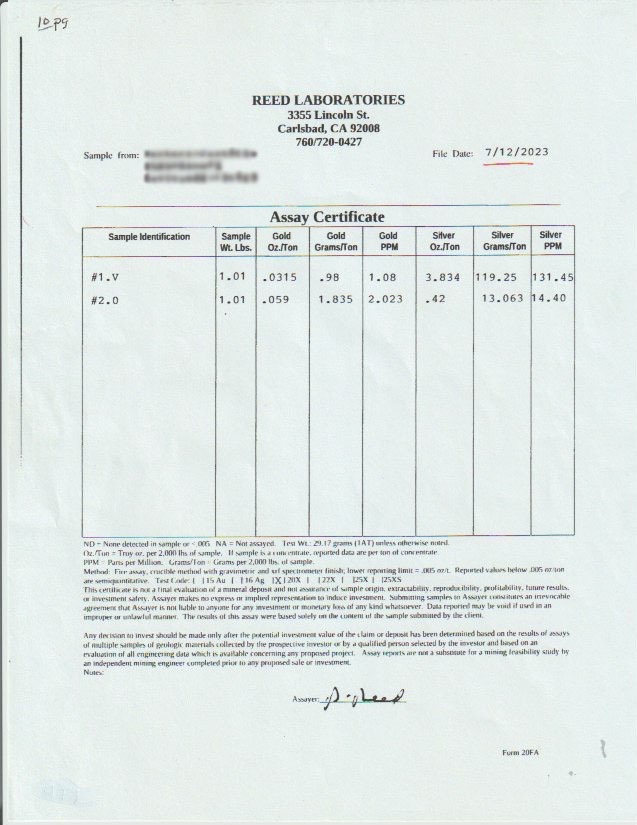
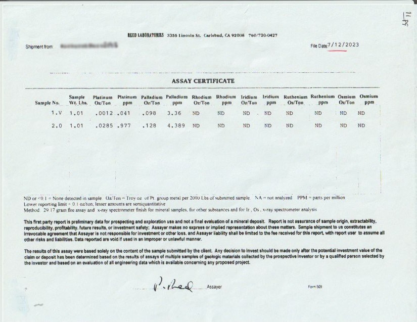
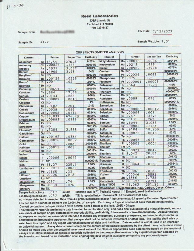
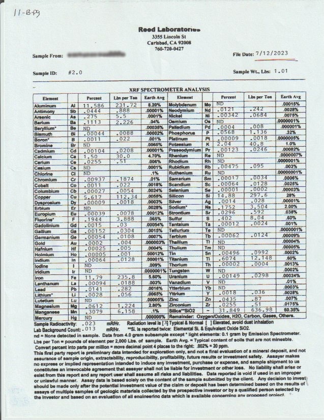
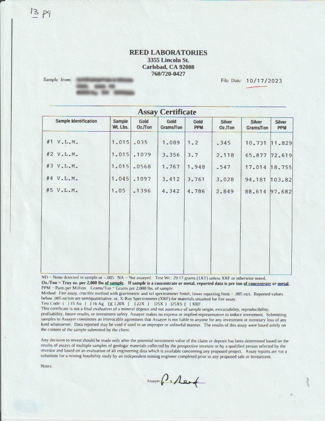
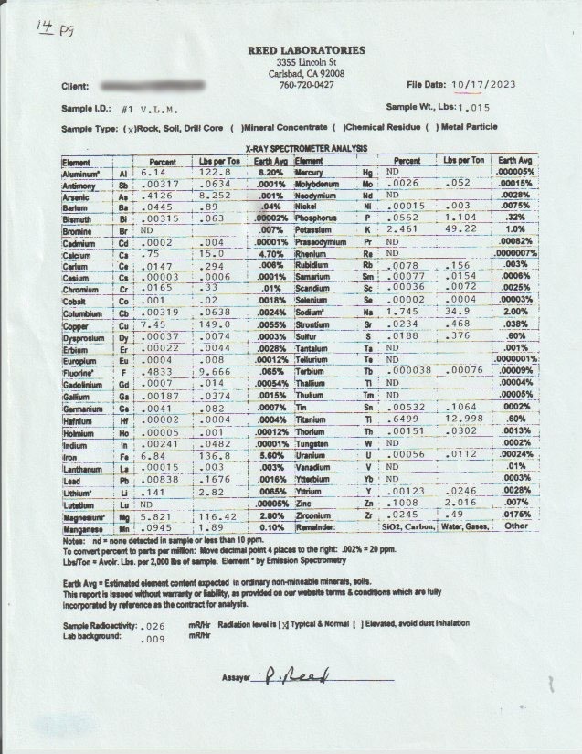
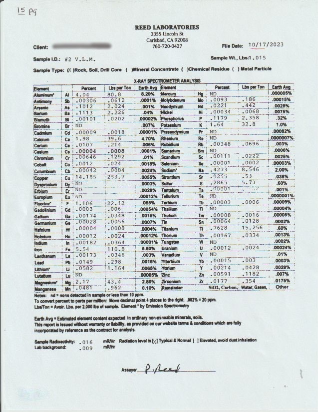
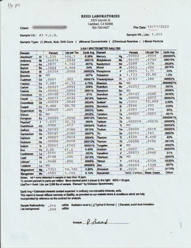
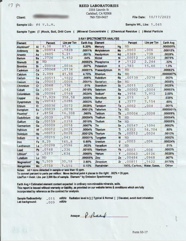
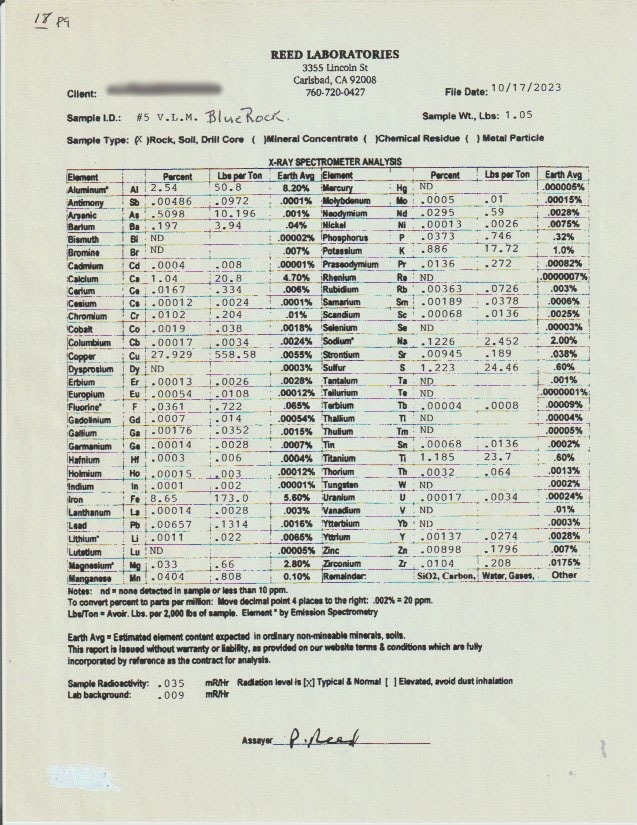
The primary mineralization is structure-controlled — hydrothermal fluids migrated along faults and deposited copper, silver, and gold. The 2023 XRF spectrometer analysis confirmed samples returning up to 27.9% Cu in the “Blue Rock” sample and as high as 33.8% Cu in others, along with platinum and palladium — elements the original Forest Service examiners never tested for.
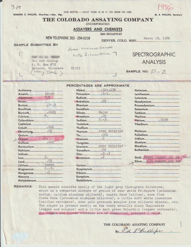
“The copper present is… heavy black metallic Chalcocite (copper and sulphur) and a little dark green Malachite (copper carbonate). The copper and silver contents are of commercial interest and value.”
Ed Phillips, The Colorado Assaying Company, 1986
Mineralogy
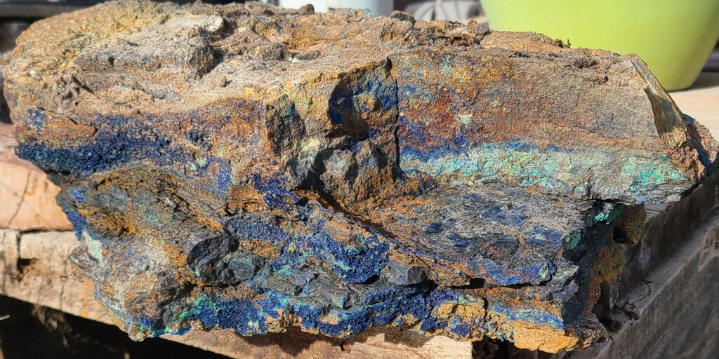
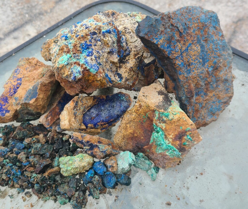
The Beauty of the Ores
The mineralization here produces something uncommon in the world of copper deposits: nuggets up to two inches across with dark, heavy chalcocite and bornite cores wrapped in vivid blankets of green malachite, deep blue azurite, and possible indigo covellite. That natural color zonation — black to iridescent purple to green to blue — creates beautiful palm-sized specimens.
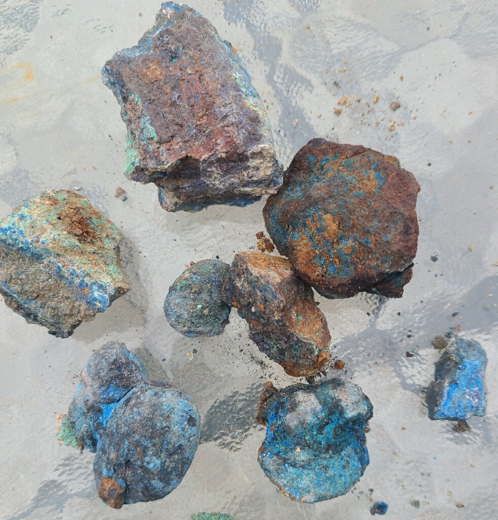
Ruby silver (pyrargyrite), cinnabar, arsenopyrite, and marcasite have also been reported in the workings, making this an exceptional specimen-quality mine with rare collectibles throughout.
Owner’s Statement & Additional Information
[ Replace this paragraph with any custom copy you would like to add — owner’s notes, investment highlights, recent developments, or any additional promotional content. This block is styled to stand out from the rest of the article text. ] [ Add a second paragraph here if needed. All formatting and link styling will match the rest of the page automatically. ]At a Glance
Virginia Lynn Features
Claim Details
Virginia Lynn Main Features
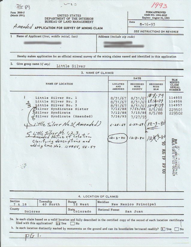
| Type of Claim | Unpatented Lodes & Millsite; CO106318746(-50) |
| Size | 82.64 Acres + 5 Acre Mill |
| Commodities | Gold, Silver, Copper, Lead, Zinc, Molybdenum, PGE |
| Accessibility | Paved Roads + Dirt Roads |
| Closest City | Rico, Colorado |
| Camping | Yes — up to 14 days at a time |
| Cell Reception | Spotty on AT&T Networks |
| Deposit Type | Lode |
| Development Status | Established Discovery |
| District | Dunton, Dolores County |
Technical Data
Economic & Geologic Information
Economic Information
| Operation Type | Lode |
| Development Status | Established Discovery |
| Commodity Type | Gold, Silver, Copper, Gems, Lead, Zinc, Molybdenum |
| Deposit Size | Unknown |
Mining District
| District Name | Dunton, Dolores County |
| Nearby Mines (MRDS) |
Emma Mine — MRDS #10166487 Rico Boy Mine — MRDS #10118566 Mountain Spring Mine — MRDS #10239264 |
Geologic Structure
| Formation | Dolores Formation |
| Primary | Sedimentary — Siltstone, Mudstone/Shale, Sandstone |
| Minor | Sedimentary — Limestone-pellet Conglomerate |
Transfer Process
Mineral Rights Transfer
A mining claim gives the holder the right to mine on mineral-rich land belonging to the federal government. Claims can be bought, sold, leased, gifted, willed, or used as collateral — transferred in part or in entirety using a quitclaim deed, just like any other real property.
Contact us anytime with questions about the transfer process. All fees and assessment paperwork are current and paid through September 1, 2026.
Boundaries & Location
Claim Boundaries & GPS Coordinates
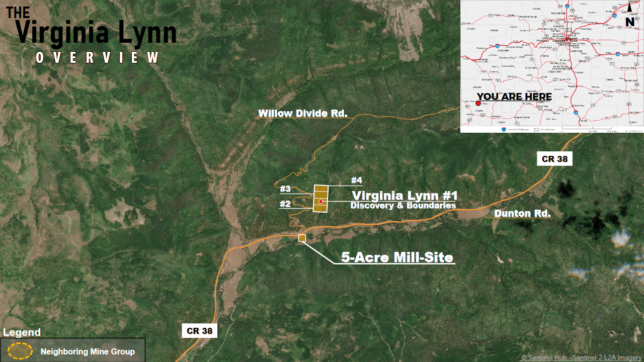
NE: 37.738801°, -108.213278° | NW: 37.738932°, -108.218489°
SE: 37.732228°, -108.213587° | SW: 37.732328°, -108.218847°
Millsite Boundaries
NE: 37.726957°, -108.221395° | NW: 37.726947°, -108.223005°
SE: 37.725677°, -108.221404° | SW: 37.725674°, -108.223030°
Open in Google Maps → Download KMZ →
Photography
The Virginia Lynn — Photographs
Click any image to open full size in a new tab.
Purchase
Purchasing “The Virginia Lynn”
Have questions? Want to see the mine in person? Ready to make an offer? We respond to all serious inquiries promptly — usually same-day.