 Placer
Sedona Legend #10
📍 Yavapai County, Arizona
- Au
$17,995
20 Acre Placer Mining Claim · Sedona Red Rock Country · Yavapai County, Arizona
$17,995
Available now! All BLM & county filing fees included. 2–4 week transfer timeline.
Part of a four-claim group — take all four for $71,980.
Last updated: September 30, 2026
Twenty Acres Along Spring Creek, Ten Miles From Uptown Sedona
The Sedona Legend #11 is one of four 20-acre placer claims in The Sedona Legend & Sunrise Claims. Buy it on its own for $17,995, or own all 80 acres for $71,980.
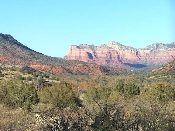
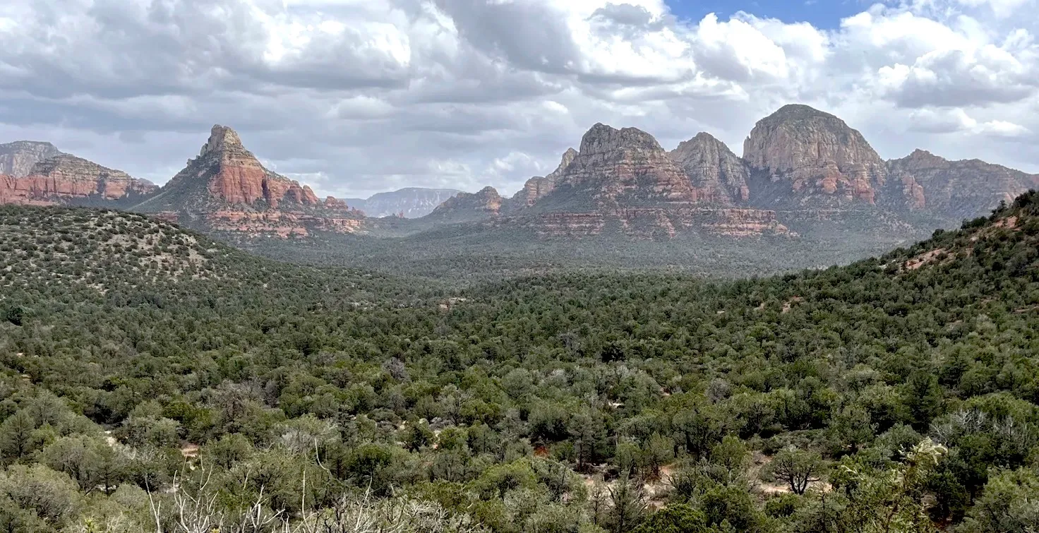
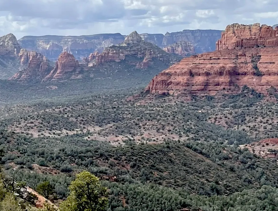
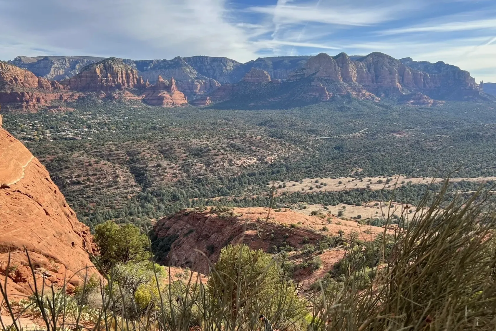
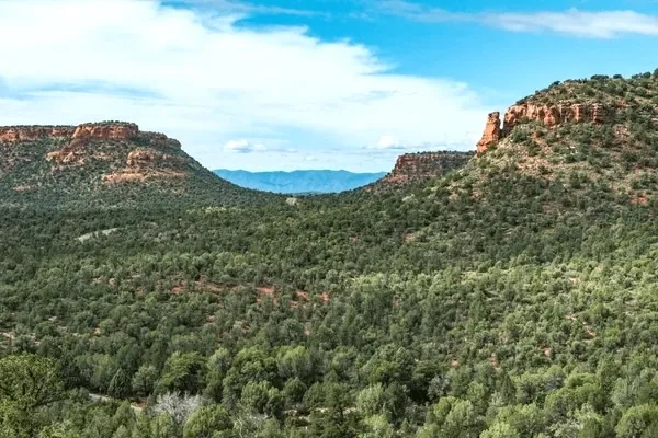
There’s something special about a claim with a creek running through it — and the Sedona Legend #11 has one. This full 20 acre unpatented placer claim lies on the Coconino National Forest, just 10 miles west of Uptown Sedona, with Spring Creek running south-southeast down the west side of the property and out across its south line. Forest Road 9549 runs along the claim’s west side, the famous Palatki and Honanki cliff dwellings are less than 4 miles away, and the Sedona Legend #10 sits right next door to the north — so you can own a contiguous 40 acres along the creek.
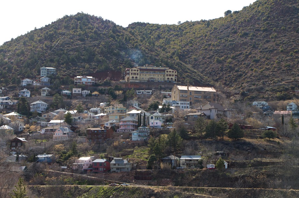
Sedona is famous for its red rocks — but this valley is also serious mining country. Just 13.3 miles southwest, on Cleopatra Hill in the Black Hills, lies Jerome, Arizona’s “Billion Dollar Copper Camp.” Montana Copper King William A. Clark took control of the United Verde mine in 1888, and between 1880 and 1930 alone it produced nearly 2 billion pounds of copper, more than 1 million ounces of gold and about 34.6 million ounces of silver. Next door, “Rawhide Jimmy” Douglas’s United Verde Extension struck bonanza ore in 1914 — ore that averaged an astonishing 23.5% copper in 1916 — and went on to pay $55 million in dividends. All told, the Jerome district turned out about 1.57 million ounces of gold.
And the claim sits in very good company: Yavapai County ranks first in Arizona for gold production, with more than 3.7 million ounces recorded through 1959 — including some 266,800 ounces of placer gold. Prospectors are still at it today, too: BLM records show about a hundred active mining claims in the surrounding townships, and more than 500 across the greater Verde Valley.
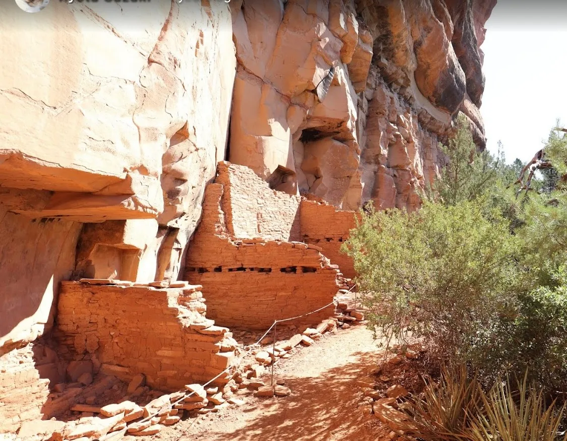
Long before the prospectors, the Sinagua people were putting the minerals of this valley to work. Their cliff dwellings at Palatki (about 3.3 miles away) and Honanki (about 3.9 miles) are among the largest in Sedona’s Red Rock country, and their walls and rock art still stand today. The Sinagua made paint from blue azurite, green malachite and red hematite, wore turquoise, and mined salt at the Camp Verde Salt Mine — which may have been worked for 2,000 years and is considered one of the oldest underground mines in America.
The Sedona Legend #11 sits on the Hermit Formation — brick-red sandstone, mudstone and pebble conglomerate laid down by rivers some 280 million years ago, when northern Arizona was the coastline of the supercontinent Pangea. It’s the same red-rock family as Bell Rock and Cathedral Rock, painted red by a thin film of hematite — iron oxide — on the sand grains. Spring Creek cuts right through the claim, and that’s great news for a placer prospector. Moving water is the world’s oldest gold pan: every flood picks up sand and gravel, and wherever the current slows — on the inside of a bend, behind a boulder, in a crack in bedrock — the heaviest particles drop out first. Twenty acres of creek, bars and benches give you plenty of places to look.
This is some of the most storied country in Arizona. In 1583 the Spanish explorer Antonio de Espejo, guided by Hopi people, reached the Verde River in search of mineral wealth and visited the mines near present-day Jerome. Prospectors filed the first copper claims at Jerome in 1876, and by 1900 the United Verde was the leading copper producer in the Arizona Territory. In 1912 the company founded Clarkdale — Arizona’s first master-planned community — whose smelter’s 430-foot brick stack, added in 1922, was once the tallest structure in Arizona. That same year crews with picks, shovels and dynamite finished the Verde Valley Railway through the red-walled Verde Canyon; today it carries visitors as the famous Verde Canyon Railroad.
Sedona itself got its post office in 1902, named for pioneer Sedona Schnebly, and from 1923 on more than 60 Hollywood productions were filmed among these red rocks. Today Sedona is an International Dark Sky Community, so the stars over your claim are as spectacular as the scenery by day.
Getting here is simple: from Sedona, take State Route 89A southwest about 5 miles past the last traffic light in West Sedona, and just past mile marker 365 turn right (north) on Forest Road 525 toward Palatki and Honanki. In about 2.8 miles, bear left onto FR 525C, the Sycamore Pass Road, then turn right (east) on FR 9549, which reaches the claim in about a third of a mile; the final stretch is best with a high-clearance vehicle. That’s roughly 6.5 miles from the highway. Fuel, supplies, restaurants and lodging are close by in West Sedona, Cottonwood and Cornville.
If you’re interested in purchasing this unpatented placer claim, please email me here.
| Type of Claim | Unpatented Claim; AZ106326435 (Placer) |
|---|---|
| Size of Claim | 20 ACRES (approx. 1,320 ft × 660 ft) |
| Mining Commodities | Placer Gold; Jasper, Quartz, Calcite & Collectible Minerals |
| Legal Location | S½ NW¼ SE¼, Section 4, T17N R4E, Gila & Salt River Meridian |
| Elevation | About 4,277 ft |
| Land Manager | Coconino National Forest, Red Rock Ranger District |
| Accessibility | SR 89A → FR 525 → FR 525C (graded forest roads) → FR 9549 (high-clearance) |
| Water | Spring Creek runs through the claim |
| Closest Towns | Sedona (~10.3 mi), Cornville (~11.3 mi), Cottonwood (~10.5 mi), Arizona |
| Camping | At the designated West Sedona camping sites nearby along FR 525, per Coconino National Forest Order 03-04-06-26-04; 14-day stay limit |
| Prior Workings | None recorded — fresh ground |
| Cell Phone Reception | Reported in the area (Verizon, AT&T, T-Mobile) |
| Type of Deposit | Placer |
| NE | 34.881781°, -111.940636° |
|---|---|
| NW | 34.881774°, -111.945042° |
| SE | 34.879936°, -111.940632° |
| SW | 34.879954°, -111.945030° |
| Monument | 34.880866°, -111.944859° (approx.) |
|---|
Corner and monument coordinates (WGS84) read from the claim’s Google Earth KMZ boundary file. USGS Loy Butte 7.5′ quadrangle; Section 4, T17N R4E, Gila & Salt River Meridian.
| Operation type | Placer |
|---|---|
| Development status | Prospect — no recorded workings |
| Commodity type | Gold; collectible minerals |
| Deposit size | Yours to discover |
| Region | Verde Valley, Yavapai County — nearest organized district is the Verde (Jerome) District, about 13.3 mi SW |
|---|---|
| Historic Mines Nearby | United Verde Mine, Jerome – ~1 million oz gold, 1880–1930 (~13.3 mi SW) United Verde Extension (UVX) – MRDS#10102464 (~13.3 mi SW) Clarkdale Smelter, 1915–1950 (~10.0 mi SW) Cherry Creek District gold mines (~22 mi SSW) Camp Verde Salt Mine – prehistoric & 1920s–30s (~23 mi S) |
| Type of Structure | Edge of the Colorado Plateau — Permian red beds of the Sedona country meeting the faulted Verde Valley basin |
|---|---|
| Structure Description | Units mapped at and around the claim (USGS SIM-2996; AZGS mapping): Hermit Formation (Early Permian) — mapped at the claim (USGS SIM-2996, DeWitt et al., 2008) Hermit Formation and Supai Group red beds — Sedona’s red rock foundation Schnebly Hill Formation & Coconino Sandstone — the famous cliffs a few miles to the north and northeast Verde Formation — lake beds of ancient Lake Verde (about 2½ to 8 million years old) to the south Verde Fault zone — the great fault that lifted Jerome’s Black Hills, across the valley |
A mining claim gives the holder the right to mine on mineral-rich land that belongs to the federal government. Mining claims are a tangible asset and show proof of all interests in minerals in the area. They can be bought, sold or used as collateral, just like any other piece of real estate.
A mining claim can be sold, traded, leased, gifted, willed, used as collateral or transferred in part or in its entirety just like any other real property using a quitclaim deed which is a recordable conveyance. Questions about the transfer process can be answered by contacting us anytime. All fees and paperwork are current.
$17,995
Cash Price
Make a one time payment and get new mineral rights transferred in your name quick and easy.
Buy Online NowEmail me for more information and additional payment options.
After your purchase is complete you will be requested to fill out our new claim owner form with your name/address or add any additional claimants you want on the claim.
Digital copies of your COL and Map of Location will be delivered via email in PDF format, as well as a Google Earth™ KMZ map file with your claim’s discovery, corners and points of interest.
We handle all the filing and transfer services on your behalf. Expect to get official stamped/recorded copies of your paperwork mailed to you from the Yavapai County Recorder’s Office and the Arizona Bureau of Land Management officiating you as the new claimant within 45 days of purchase. Then officially enjoy prospecting on your own claim!
Sedona Legend #11 is a 20 acre placer mining claim in the Verde Valley of Yavapai County, Arizona, in the red rock country west of Sedona. It comes to market in an extraordinary metals environment, with spot gold trading around $4,180 an ounce on September 30, 2026 — more than $300 higher than a year earlier — after setting an all-time high of nearly $5,600 an ounce in late January, and silver holding above $60. At these prices, every speck in the pan counts.
Metals produced in the Verde Valley region include:
Rocks and minerals for the collector in the region’s formations:
The Verde Valley region has produced gold, silver, copper, lead and zinc from the great ore bodies of Jerome, and salt, gypsum and rare sodium minerals like thenardite and glauberite from the ancient lake beds near Camp Verde. Closer to home, the area’s limestones offer jasper-like chert, quartz and calcite, and petrified wood has been reported in old gravels of the nearby Sycamore Canyon area — a fun bonus for the rockhound while you prospect.
The Sedona Legend #11 sits at about 4,277 ft at the center of the claim, in the USGS Loy Butte 7.5′ quadrangle, west of Sedona and north of State Route 89A. The claim area is characterized by:
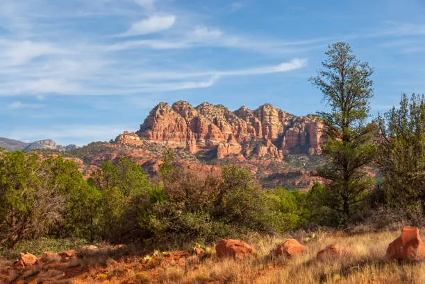
This claim is an opportunity to own 20 acres of placer mineral rights in one of the most beautiful corners of the American West — with a front-row seat to Sedona’s red rocks and the rich mining history of the Verde Valley.
The Verde Valley stretches from the Black Hills and Jerome on the southwest to the red rock cliffs of Sedona and the Mogollon Rim on the northeast. Starting some ten to fourteen million years ago, movement on the Verde Fault lifted the Black Hills and dropped the valley; ancient Lake Verde filled it for millions of years before spilling over about 2½ million years ago to form today’s Verde River, about 6.8 miles from the claim. Around it lie some of the great names of Arizona history: Jerome, Clarkdale, Tuzigoot (about 8.9 miles), Montezuma Castle, and the Sinagua cliff dwellings of Palatki and Honanki.
Today the area is one of the most loved destinations in the Southwest, with world-class hiking, wineries along the Verde Valley Wine Trail in Cornville and Page Springs, the Verde Canyon Railroad, and the galleries and restaurants of Sedona and Jerome. A claim here is a place to prospect, explore and enjoy for years to come — and the Sedona Legend #11 puts you right in the middle of it.
Satellite view of the claim area. Click the pin for a quick summary.
Satellite view of the claim area. Exact corner and discovery-monument coordinates are published above, and the Google Earth KMZ is available for download.
The rest of the Sedona Legend & Sunrise group — see all four together.