 Placer
Sedona Legend #10
📍 Yavapai County, Arizona
- Au
$17,995
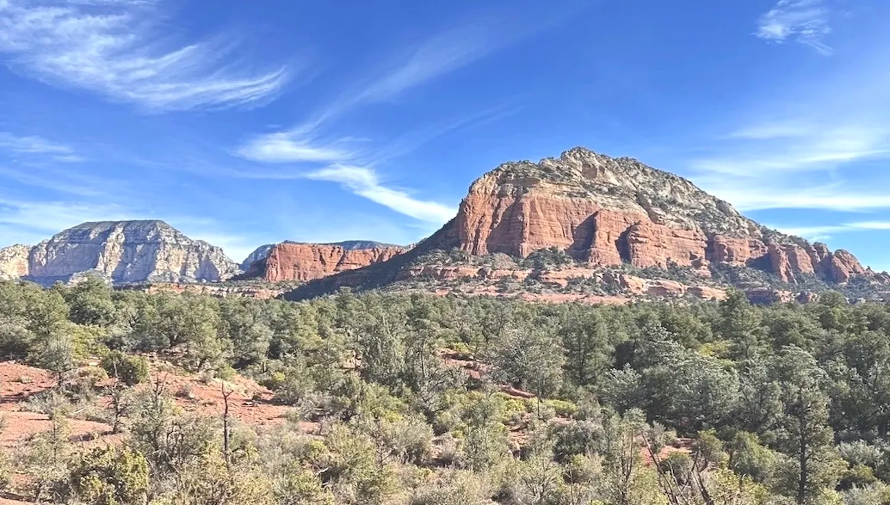
Four 20 Acre Placer Claims · 80 Acres · Sedona Red Rock Country · Yavapai County, Arizona
$71,980
All four claims — or choose any claim on its own for $17,995.
Available now! All BLM & county filing fees included. 2–4 week transfer timeline.
Last updated: September 30, 2026
Eighty Acres of Placer Ground in America’s Most Beautiful Red Rock Country
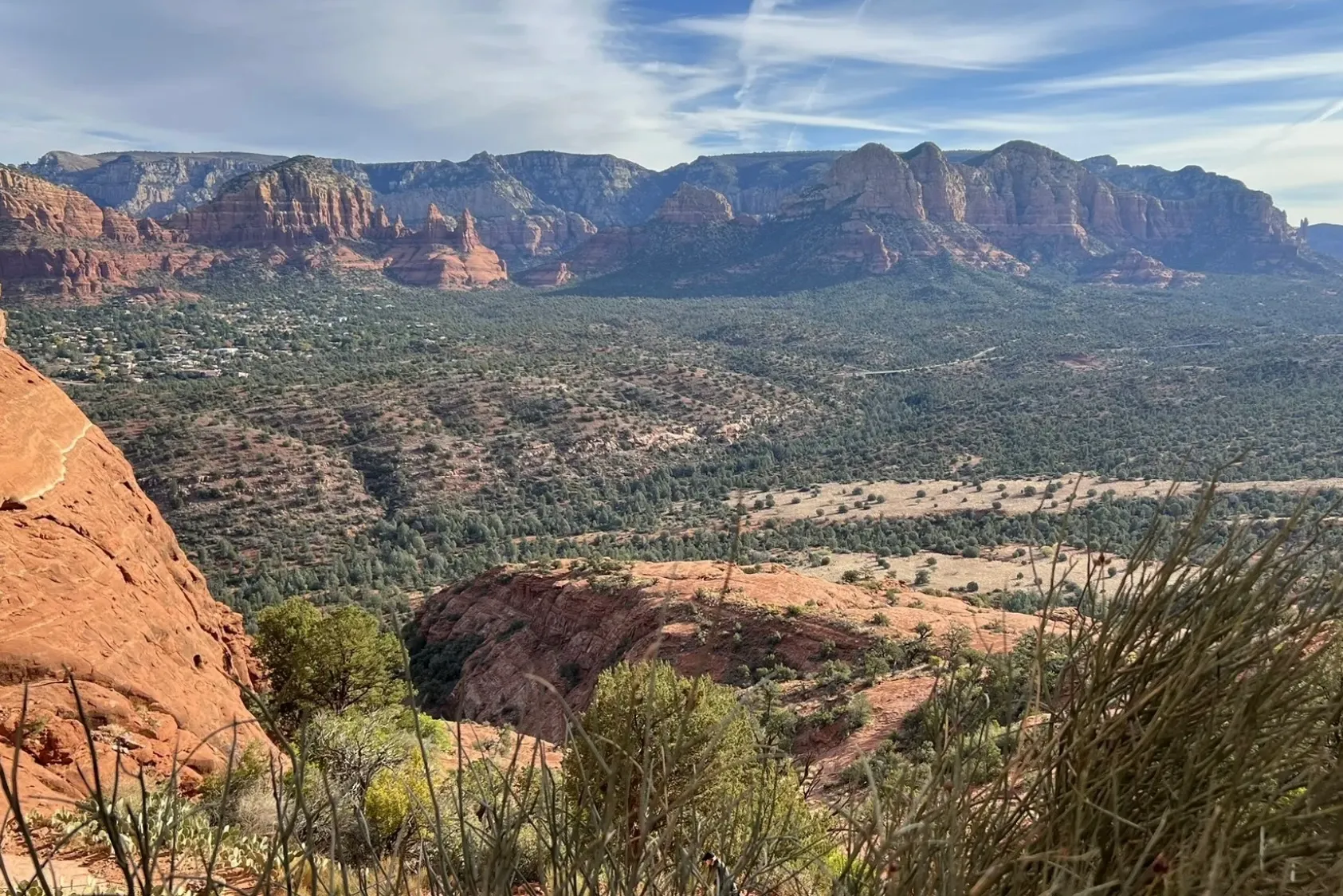
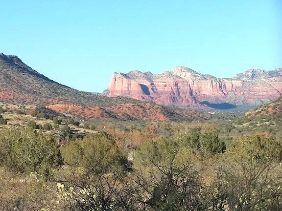
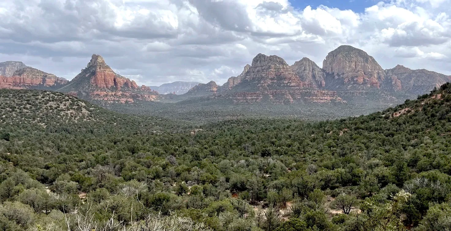
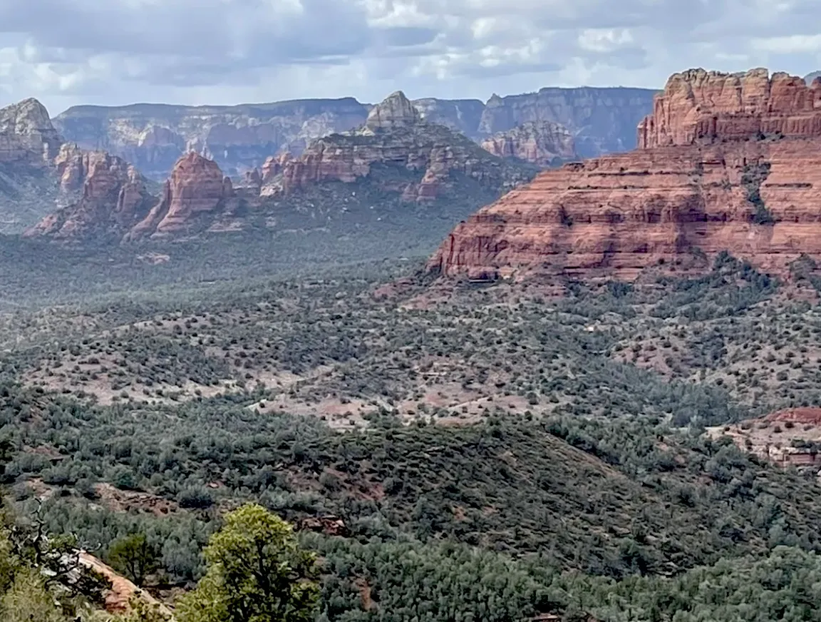
Few places on earth are as instantly recognizable as Sedona’s red rocks — and now you can own the mineral rights to a piece of them. The Sedona Legend & Sunrise Claims are four full 20 acre unpatented placer claims on the Coconino National Forest, about 10 miles west of Uptown Sedona and 8 miles from West Sedona, in the high-desert juniper country between the red rock cliffs and the Verde Valley. All four are reached on graded Forest Roads 525 and 525C, just 5 to 7 miles off State Route 89A (a high-clearance vehicle is recommended).
Buy the one that speaks to you for $17,995, pair up the two side-by-side Legend claims for a contiguous 40 acres along Spring Creek, or take all 80 acres for $71,980.
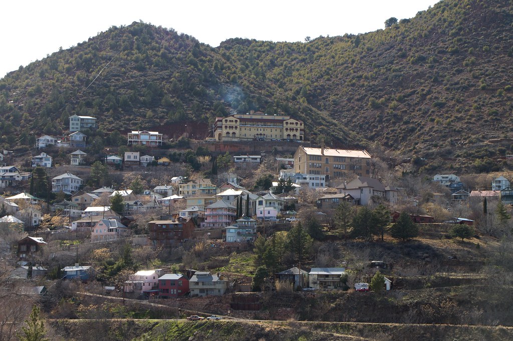
Sedona is famous for its scenery — but the Verde Valley is also serious mining country. About 13 miles southwest, on Cleopatra Hill in the Black Hills, lies Jerome, Arizona’s “Billion Dollar Copper Camp.” Montana Copper King William A. Clark took control of the United Verde mine in 1888, and between 1880 and 1930 alone it produced nearly 2 billion pounds of copper, more than 1 million ounces of gold and about 34.6 million ounces of silver. Next door, “Rawhide Jimmy” Douglas’s United Verde Extension struck bonanza ore in 1914 that averaged 23.5% copper in 1916 and paid $55 million in dividends. All told, the Jerome district turned out about 1.57 million ounces of gold.
Yavapai County ranks first in Arizona for gold production, with more than 3.7 million ounces recorded through 1959 — including some 266,800 ounces of placer gold — and prospectors are still busy here today, with about a hundred active mining claims on BLM record in the surrounding townships and more than 500 across the greater Verde Valley.
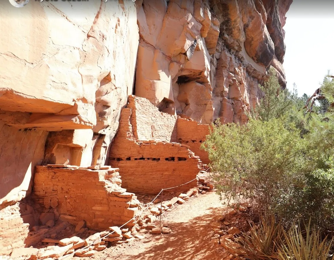
Long before the prospectors arrived, the Sinagua people built the cliff dwellings of Palatki and Honanki, just 3 to 5 miles from these claims. They made paint from blue azurite, green malachite and red hematite, wore turquoise, and mined salt at the Camp Verde Salt Mine — which may have been worked for 2,000 years and is considered one of the oldest underground mines in America. In 1583 the Spanish explorer Antonio de Espejo, guided by Hopi people, came up the Verde River looking for mineral wealth and found the mines near present-day Jerome. The first copper claims there were filed in 1876; Clarkdale, Arizona’s first master-planned community, followed in 1912, along with the Verde Valley Railway that today carries visitors as the Verde Canyon Railroad.
Sedona itself got its post office in 1902, named for pioneer Sedona Schnebly, and more than 60 Hollywood productions were filmed among these red rocks from 1923 on. Today Sedona is an International Dark Sky Community — red rocks by day, the Milky Way by night.
These four claims sit right where two great landscapes meet — and that’s what makes the area so interesting to a prospector and rockhound.
To the north and east rise Sedona’s famous red rock layers — the Supai, Hermit and Schnebly Hill formations, laid down by rivers, tides and coastal dunes on the edge of the supercontinent Pangea some 275 to 300 million years ago, and capped by the pale Coconino Sandstone. Their color comes from a thin film of hematite — iron oxide — coating the sand grains. In other words, Sedona’s rocks are rusted! The two Sedona Legend claims sit right on the brick-red Hermit Formation, with its sandstone, mudstone and pebble conglomerate, and Spring Creek cuts across both of them.
Starting some 10 to 14 million years ago, movement on the great Verde Fault lifted the Black Hills — home of Jerome’s billion-dollar ore bodies — and dropped the Verde Valley. Rivers poured sand and gravel into the basin, and ancient Lake Verde filled it for millions of years, stretching nearly 35 miles across the valley and reaching from Jerome toward Sedona, before spilling over about 2½ million years ago to form today’s Verde River. The two Sedona Sunrise claims sit on these younger basin sediments — sandstone, siltstone and conglomerate — at the northern edge of the lake beds. Older river gravels preserved on the rim above nearby Sycamore Canyon are about 45% schist and 35% granite — ancient basement rock carried north by rivers flowing from the south.
Placer prospecting is all about moving water. Every summer monsoon sends floodwater racing down the creeks and washes, and wherever the current slows — on the inside of a bend, behind a boulder, in a crack in bedrock — the heaviest material drops out first. Between them, these claims have Spring Creek running through the two Legend claims and seasonal washes crossing and flanking the two Sunrise claims, giving you plenty of natural sorting channels to explore.
| Sedona Legend #10 | BLM AZ106326434 N½ NW¼ SE¼, Section 4, T17N R4E, Gila & Salt River Meridian About 4,290 ft · Spring Creek crosses the west side of the claim $17,995 |
|---|---|
| Sedona Legend #11 | BLM AZ106326435 S½ NW¼ SE¼, Section 4, T17N R4E, Gila & Salt River Meridian About 4,277 ft · Spring Creek runs through the claim $17,995 |
| Sedona Sunrise #15 | BLM AZ106326422 N½ NE¼ NW¼, Section 9, T17N R4E, Gila & Salt River Meridian About 4,337 ft · Seasonal washes just north and south of the claim; Spring Creek about ¼ mile east $17,995 |
| Sedona Sunrise #12 | BLM AZ106326419 S½ NW¼ SW¼, Section 9, T17N R4E, Gila & Salt River Meridian About 4,266 ft · Two seasonal washes cross the claim; Coffee Creek about ½ mile southwest $17,995 |
| Type of Claims | Four Unpatented Placer Claims |
|---|---|
| Total Size | 80 ACRES (four 20-acre claims, each approx. 1,320 ft × 660 ft) |
| Mining Commodities | Placer Gold; Jasper, Quartz, Calcite & Collectible Minerals |
| Legal Location | Sections 4 & 9, T17N R4E, Gila & Salt River Meridian |
| Land Manager | Coconino National Forest, Red Rock Ranger District |
| Accessibility | SR 89A → FR 525 → FR 525C (graded forest roads; high-clearance recommended), 5 to 7 miles from the highway |
| Closest Towns | Sedona (~10–11 mi), Cottonwood (~9½–10½ mi), Cornville (~10½–11½ mi), Arizona |
| Camping | At the designated West Sedona camping sites nearby along FR 525, per Coconino National Forest Order 03-04-06-26-04; 14-day stay limit |
| Prior Workings | None recorded — fresh ground |
| Cell Phone Reception | Reported in the area (Verizon, AT&T, T-Mobile) |
| Type of Deposit | Placer |
Each claim page has its four corners, discovery monument, a downloadable Google Earth KMZ and an interactive map.
From Sedona, take State Route 89A southwest about 5 miles past the last traffic light in West Sedona. Just past mile marker 365, turn right (north) on Forest Road 525, the road to Palatki and Honanki. In about 2.8 miles, bear left onto FR 525C, the Sycamore Pass Road:
Coming from Cottonwood? Take Bill Gray Road (FR 761) north from SR 89A; it meets FR 525C right beside the Sedona Sunrise #15. Fuel, supplies, restaurants and lodging are close by in West Sedona, Cottonwood and Cornville.
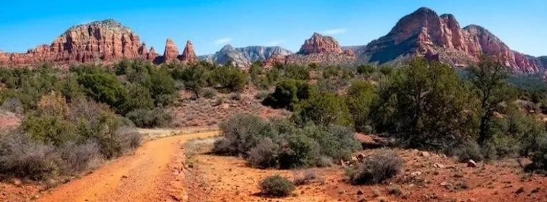
The Sedona Legend & Sunrise Claims are four 20 acre placer claims in the Verde Valley of Yavapai County, Arizona. It comes to market in an extraordinary metals environment, with spot gold trading around $4,180 an ounce on September 30, 2026 — more than $300 higher than a year earlier — after setting an all-time high of nearly $5,600 an ounce in late January, and silver holding above $60. At these prices, every speck in the pan counts.
Metals produced in the Verde Valley region include:
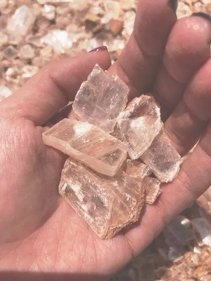
Rocks and minerals for the collector in the region’s formations:
$71,980
All Four Claims · Cash Price
Make a one time payment and get all four claims transferred into your name quick and easy — or choose any single claim for $17,995.
Buy Online NowA mining claim can be sold, traded, leased, gifted, willed, used as collateral or transferred in part or in its entirety just like any other real property using a quitclaim deed which is a recordable conveyance. We handle all the filing and transfer services on your behalf. Expect to get official stamped/recorded copies of your paperwork mailed to you from the Yavapai County Recorder’s Office and the Arizona Bureau of Land Management officiating you as the new claimant within 45 days of purchase. Email me for more information and additional payment options.
Satellite view of the claims area. Click the pin for a quick summary.
Satellite view of the claims area. Exact corner and discovery-monument coordinates are published on each claim’s page, and the Google Earth KMZ is available for download.
Each claim is $17,995 — or take all four for $71,980.
Every claim currently for sale, sorted by price. Tap a name to open the full listing.
| Claim | Price | Commodity | County / State | Acreage |
|---|---|---|---|---|
| The Virginia Lynn | $1,000,000 | Silver, Gold, Copper +4 | Dolores County, Colorado | 87.64 |
| The Sedona Legend & Sunrise Claims you’re here | $71,980 | Gold | Yavapai County, Arizona | 80 |
| Mountain View Tungsten Project | $65,000 | Tungsten, Copper | Lyon County, Nevada | ~140 |
| Ophy I-V Claims | $41,250 | Gold, Silver, Copper | Boise County, Idaho | 79.35 |
| Sunny Side Up #1-2 | $21,500 | Gold, Silver | Southeast Fairbanks, Alaska | 80 |
| Boulder #2 & #3 | $15,000 | Gold, Silver | Boise County, Idaho | 41.32 |
| The Winna-Winner Claims | $10,000 | Gold, Silver, Iron +2 | Humboldt County, Nevada | 40 |
| Belcher Canyon | $9,997 | Gold | Nye County, Nevada | 20 |
| The Golden Trinity Claim | $8,000 | Gold, Platinum, Silver | Trinity County, California | 20 |
| Marigold #1 | $7,500 | Gold, Silver | Yavapai County, Arizona | 20 |
| Ayers Claim | $6,500 | Gold, Silver | Sierra County, California | 20 |
| The Eureka Comstock Placer | $5,000 | Gold, Copper, Silver | Washoe County, Nevada | 20 |
Prices and availability change as claims sell. Ask about any of these or see what has already sold.