 Placer
Belcher Canyon
📍 Nye County, Nevada
- Au
$9,997
41.32 Acre Lode Mining Claims · Idaho City District · Boise County, Idaho
$15,000
All BLM & county filing fees included. 10-day transfer guaranteed.
41.32 Acre Gold Claim, Idaho
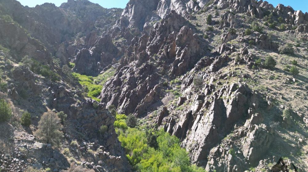
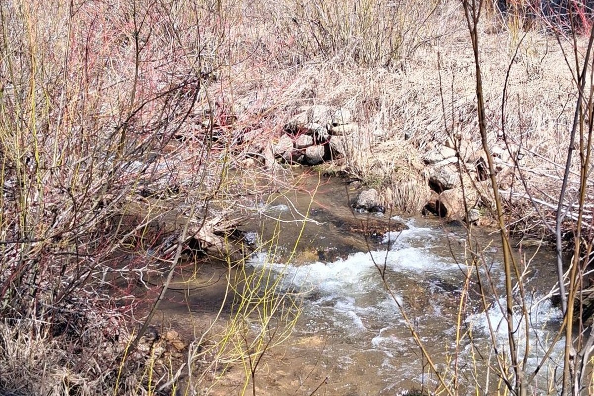
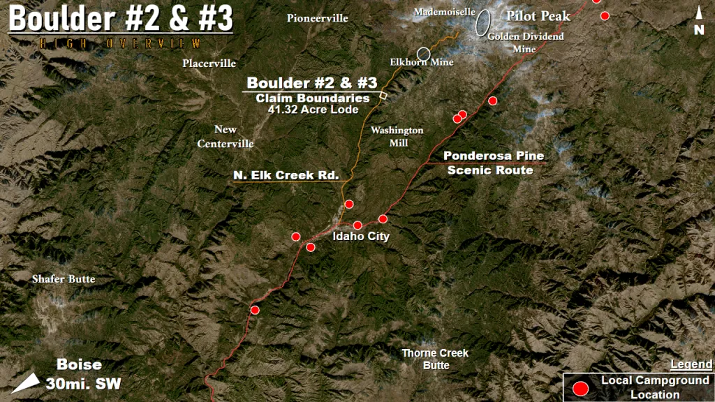
Just an hour-and-a-half drive from the center of Boise, Idaho, the beautiful Boulder #2 & #3 claims are situated straight on the Elk Creek! Staked as two 20.66 acre lode claims leading into the mountain to the Creek’s East, the claims have the unique potential to be used as both as a dredgeable placer and as a hard-rock mining operation!
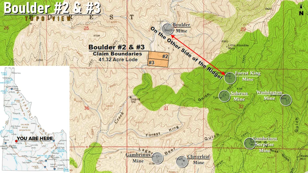
The Boulder claims find their historical roots right next to the old Boulder Mine itself, which went searching for source the County’s illusive placer gold deep within the Northern Rocky Mountains. While the entire Idaho City Mining District has profited from the easy capture of placer gold from its rivers and streams since the 1870s, a dedicated effort to find the source of all this easy gold in the mountains themselves led to an abundance of lode mining. In a report from 1947, mines like the Elkhorn, just 2.1 miles to the Northeast and claimed on the same ridge as the Boulder, took in $800,000 in its time (a whopping $12.5 million in today’s money)!
On the same mountain as the Boulder and Elkhorn but on the other side of the ridge sits the Subrosa and its nearby sister mines, the Forest King and the Washington, and a little farther out sit the Texida, Cloverleaf and Gambrinus Mine! All clearly harvesting from the same, gold-rich vein that seems to stretch all the way back up to Pilot Peak, the Boulder finds its own quiet place away from the heavy traffic on the other side while still profiting from all the golden ore.
What’s more, the claim sits on the Elk Creek. The river is perfect and large enough for a 5″ dredge, with plenty of waterflow and a plenty of ground to bedrock. Upstream, mines like the Elkhorn have taken large amounts of gold and silver. Further upstream to Pilot and Freeman Peaks, the Red Lodge Mine, the Golden Dividend, and the Mademoiselle sit counting their gold collected from underground. But little do they know, five-and-a-half miles as the crow flies to Freeman Peak and all the mountain’s gold in-between gets captured by the Elk Creek every rain through natural erosion. As heavy rains push heavy gold further downstream, the Boulder sits at the beginning of a naturally riffled S-curve, ready to capture it all (check out Jeff William’s video on how gold flows with a realistic model and how it’ll behave here)!
The claims are easy to access, with the N. Elk Creek Road leading right to them. This well-maintained dirt follows the Elk Creek all the way back up to its origin at the top of the mountain. It also plunks you down right next to your gold claims without having to hike or off-road anywhere!
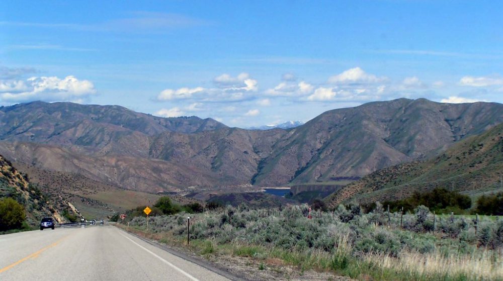
With plenty of trails, hiking, and history to be found in the mountains surrounding the claim, the area is ripe for a future campsite. While finding some prepared ground near the claims might be difficult, Idaho City proper and up the Ponderosa Pines Scenic Route Road lie a half a dozen campsites to plant a tent or a trailer to pop back to when it gets dark. Just a few miles away from Idaho City and the campgrounds, you could spend all day panning and dredging for gold!
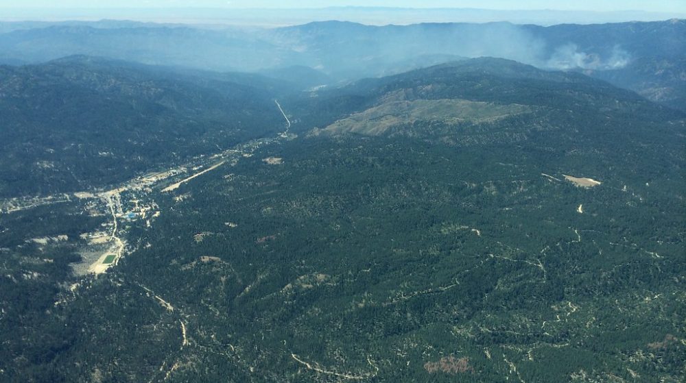
If you’re interested in purchasing these unpatented lode gold claims in Idaho, please email me here.
| Type of Claim | Unpatented Lodes; ID106695682, ID106695683 |
|---|---|
| Size of Claim | 41.32 ACRES |
| Mining Commodities | Gold, Silver |
| Accessibility | Well-Maintained Dirt Roads |
| Closest City | Idaho City, Idaho |
| Camping | Yes. Up to 14 days at a time |
| Prior Workings | Yes |
| Cell Phone Reception | Some Bars on All Networks but Verizon |
| Type of Deposit | Lode |


| NE | 43.911125°, -115.790260° |
|---|---|
| NW | 43.911481°, -115.795930° |
| SE | 43.907862°, -115.790926° |
| SW | 43.908218°, -115.796596° |
| Monument | 43.910590°, -115.794941° |
|---|
| Monument | 43.908970°, -115.795276° |
|---|
Corner and monument coordinates (WGS84) read from the claim’s official Google Earth KMZ boundary file.
| Operation type | Lode |
|---|---|
| Development status | Prospect |
| Commodity type | Gold, Silver |
| Deposit size | Unknown |
| District Name | Idaho City Mining District, Boise County |
|---|---|
| Deposit MAS/MILS ID |
Boulder Mine – MRDS #10119795 Elkhorn Mine – MRDS #10168422 Texida Mine – MRDS #10120025 |
| Type of Structure | Granodiorite and Two-Mica Granite |
|---|---|
| Structure Description |
(MAJOR) – Granodiorite Igneous > Plutonic > Granitic Igenous > Plutonic > Granodiorite |
A mining claim gives the holder the right to mine on mineral-rich land that belongs to the federal government. Mining claims are a tangible asset and show proof of all interests in minerals in the area. They can be bought, sold or used as collateral, just like any other piece of real estate.
A mining claim can be sold, traded, leased, gifted, willed, used as collateral or transferred in part or in its entirety just like any other real property using a quitclaim deed which is a recordable conveyance. Questions about the transfer process can be answered by contacting us anytime. All fees and paperwork current and assessment fees are paid through Sept. 1st 2026.
$15,000
Cash Price
Make a one time payment and get new mineral rights transferred in your name quick and easy.
BUY NOW!After your purchase is complete you will be requested to fill out our new claim owner form with your name/address or add any additional claimants you want on the claim.
You’ll get digital copies of your COL and Map of Location in to your claim(s) will be delivered via email via PDF format as well as Google Earth™ KMZ map file with your claims discovery, corners and points of interest.
We handle all the filing and transfer services on your behalf. Expect to get official stamped/recorded copies of your paperwork mailed to you from the Boise County Recorder’s Office and the Idaho Bureau of Land Management officiating you as the new claimant within 45 days of purchase. Then officially enjoy mining gold on your own land!
Boulder #2 & #3 are 41.32 acre lode mining claims located in the historic Idaho City District of Boise County, Idaho. The Idaho City District was the site of one of the largest gold rushes in the American West during the 1860s, producing millions of dollars in gold and silver.
Primary and secondary commodities on these claims include:
The Idaho City District is underlain by granitic intrusive rocks and metamorphosed sedimentary units that host numerous quartz veins containing free-milling gold and silver. The district’s geology is classic Basin-and-Range terrain, with fault-controlled mineralization that has been productive for over 150 years.
The Boulder #2 & #3 claims are situated in the heart of Idaho’s most famous gold district. The claim area is characterized by:
The 41.32-acre claim package provides extensive coverage over the mineralized trend, offering both immediate small-scale mining potential and long-term exploration upside.
The Idaho City District was discovered in 1862 and quickly became one of the richest placer and lode gold districts in the Pacific Northwest. At its peak, Idaho City was the largest city in the Pacific Northwest, with a population exceeding 20,000. The district has produced an estimated $250 million in gold (at historic prices) from both placer and lode operations.
The district’s lode deposits consist of quartz veins in granite and metamorphic rocks, with free-milling gold that is easily recoverable by gravity methods. Modern exploration continues to identify new targets within the established mineralized trends, and the area remains popular with recreational and small-scale miners.
The Boulder #2 & #3 claims sit within this proven mineralized corridor, offering both the security of a historic district and the upside of underexplored ground.
Satellite view of the claim area. Click the pin for a quick summary.
Approximate district-level location shown to protect the exact claim boundaries. Contact us for precise coordinates and a guided map.
Explore other active lode and placer claims.