 Placer
Belcher Canyon
📍 Nye County, Nevada
- Au
$9,997
8-Claim Tungsten Skarn Block · Churchill Mining District · Lyon County, Nevada
$65,000
Cash price. Contact us to begin the mineral rights transfer.
Satellite view of the eight-claim Mountain View block on the southeast flank of Churchill Butte. The shaded outline follows the owner's digitized claim corners. Click the pin for a quick summary.
Claim outline digitized from the owner's own GPS survey of the eight located corners, June 2026 — indicative and subject to BLM confirmation, not a certified corner survey. Contact us for the KMZ file and current boundary information.
Two Historic Tungsten Sites, Now Held as One Controlled Trend
The Mountain View Tungsten Project is a contiguous group of eight unpatented lode mining claims covering historic scheelite (tungsten) workings on the southeast flank of Churchill Butte, in the Churchill Mining District, Lyon County, Nevada — anchored by the past-producing Ruth Mine and the historic Mountain View Group. Both sites were worked during the World War II tungsten boom of the early 1940s. USGS records catalogue the Ruth as a past producer of scheelite ore averaging roughly 0.4–0.6% WO₃, while the Mountain View Group, 0.83 mile south, is a developed prospect with a shaft and surface-underground workings. Mineralization is a classic contact-metamorphic skarn system — scheelite hosted in silicated limestone and skarn beds near the contact of a Late Cretaceous granodiorite intrusion with metasedimentary rocks.
Before 2026 this was two isolated showings with open ground between them. Six new claims — Mountain View 2 through 7 — were located that year to bridge the gap and hold the projected trace of the intrusive contact running between the two historic workings, so the whole trend now sits in one hand: roughly three quarters of a mile of controlled skarn contact, not two prospect pits.
Churchill Butte sits about thirty miles east of Reno on the US-50 / Alternate 95 corridor — a graded road reaches the workings, Fernley and the Union Pacific mainline are fifteen kilometres southwest, and an assay lab in Reno turns samples around in ten to fourteen days. Most historic tungsten ground in Nevada is a two-hour drive from anywhere on roads that wash out; this one isn't.
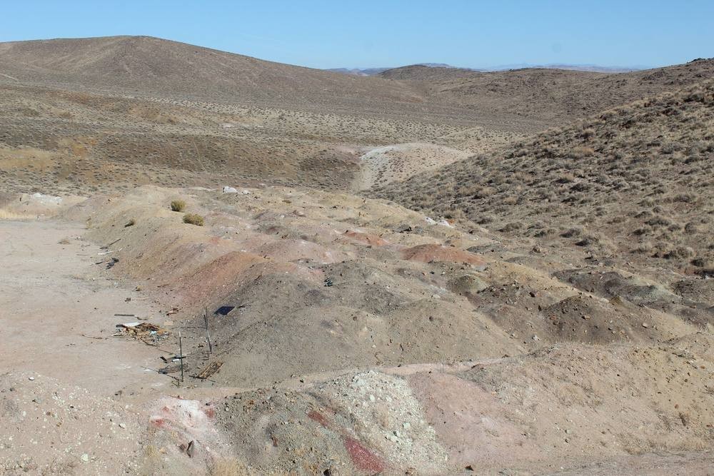
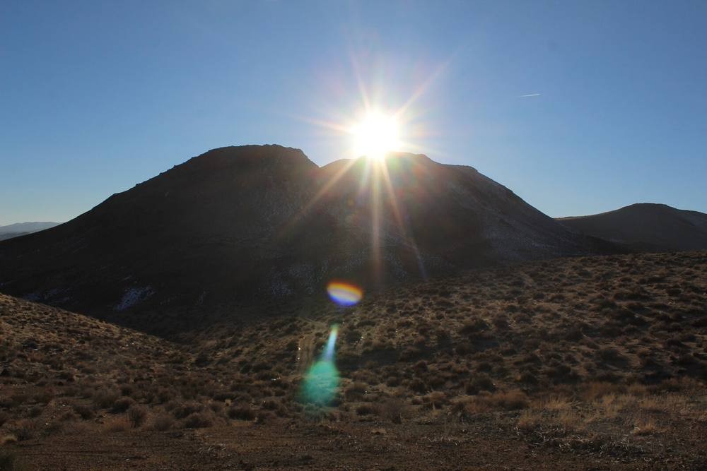
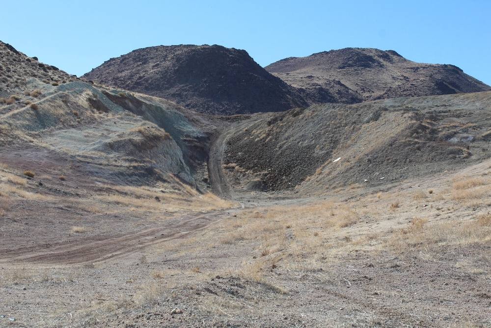
I have walked this ground. The photographs on this listing are mine, taken in April and July of 2023, and the claim outline was digitized off my own GPS work.
So here is the honest version. There is no resource here. Nobody has ever put a drill hole in this property, there is not a single modern assay in the public record, and the Ruth produced under 400 tons before it shut in the fifties. Anyone telling you what is in the ground at Churchill Butte is guessing, me included.
What I can tell you is what is documented. Two historic tungsten sites 0.83 mile apart, on the same granodiorite contact, with scheelite still visible at surface when the Nevada Bureau of Mines and Geology re-sampled it in 1989. Eight claims that now hold the ground between them. A graded road to the workings and Reno forty five minutes away. And a metal that went from $405 to $3,050 a metric tonne unit in fifteen months because China stopped exporting it — with a Department of War procurement ban on Chinese tungsten landing 1 January 2027.
In my opinion that combination is worth $65,000 to the right buyer, and worth nothing at all to the wrong one. If you are looking for a proven deposit, this is not it and I will say so on the phone. If you are looking for a cheap, de-risked entry onto a real contact in the middle of a tungsten squeeze, come look at it with me. Give me a call anytime.
— Will Hales, Mountain Man Mining LLC
This listing is the summary. The full standalone project site carries the complete geologic report, drill-target maps and 3D renderings, the tungsten market analysis, and the full 59-photo field set from the 2023 site visits.
View the Full Project Site ↗The package is eight unpatented federal lode claims located under the General Mining Law of 1872. The Ruth claim covers the past-producing adits and mined block on the north end; Mountain View 1 covers the historic shaft and surface-underground workings of the Mountain View Group. Mountain View 2 through 7 were staked in 2026 to bridge the two and hold the projected trace of the granodiorite contact in between.
| Ruth | 21.4 acres — existing core claim; past producer, two short adits, dozer cuts, pits, trenches, mined block, four pits ~1,000 ft north |
|---|---|
| Mountain View 1 | 20.2 acres — existing core claim; historic Mountain View Group shaft (aka Godwin Tungsten Mine) |
| Mountain View 2 | 20.8 acres — located 2026; south end of contact column, north of the shaft |
| Mountain View 3 | 21.0 acres — located 2026; southern column, along strike |
| Mountain View 4 | 19.1 acres — located 2026; central column |
| Mountain View 5 | 18.5 acres — located 2026; northern column |
| Mountain View 6 | 19.3 acres — located 2026; top row, extending west |
| Mountain View 7 | 14.1 acres — located 2026; top row, ties to the Ruth claim |
Note: a maximum-size lode claim is 20.66 acres (1,500 × 600 ft), so eight claims cap out at 165 acres; the block is commonly described in marketing materials as roughly 140 acres of consolidated footprint.
Two USGS Mineral Resources Data System (MRDS) records anchor the block. The Ruth is catalogued as a past producer; the Mountain View Group as a developed prospect. Both are tied to the same contact-metamorphic tungsten skarn system on the Churchill Butte intrusion.
| USGS Status | Past producer |
|---|---|
| First Production | 1941 |
| Grade, Mined Block | 0.4–0.5% WO₃ (quoted average ~0.6% WO₃) |
| Northern Pits (4) | 0.1–0.2% WO₃ in 3 of 4 pits |
| Recorded Output | Under ~400 tons (Quade, 1989) |
| Mined Block | ~50 × 6 × 15 ft, surface–underground |
| Aliases | B.H. & V. Mine, Rainbow Group, Churchill Butte Mine, Ruth No. 1 |
| 1989 NBMG Resample | Site #4291 — “good visible scheelite in remaining skarn” (qualitative, no assay recorded) |
| USGS Status | Prospect |
|---|---|
| Operation Type | Surface–underground (shaft) |
| Recorded Production | None |
| Alias | Godwin Tungsten Mine |
| Mapped Host at Site | Andesite / intermediate rocks (not carbonate — see geology note below) |
| Coordinates (WGS84) | 39.3174° N, 119.27819° W · elevation 1,301 m (4,268 ft) · ±10 m accuracy |
| PLSS | Mount Diablo Meridian, T17N R24E, Section 22, S½S½S½ |
| Reported | Ridenour, J., U.S. Bureau of Mines, 21-Apr-1993 |
Note: the Mountain View Group's mapped host rock at the recorded point is andesite, not carbonate — a detail worth resolving with a hand lens and a UV lamp before committing significant capital. MRDS records document historic exploration and reported occurrences; they are not a certification of ore grade, tonnage, or current claim status.
Contact-Metamorphic Tungsten Skarn on a Late Cretaceous Granodiorite Margin
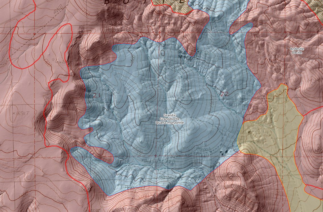
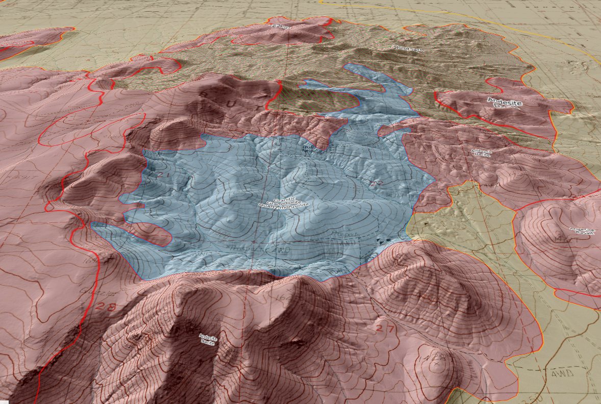
The deposit type is USGS model 14a, tungsten skarn: scheelite in calc-silicate metasomatic rock next to a granitic intrusion in a carbonate host. Churchill Butte sits in the northern Basin and Range. The host stratigraphy is older — Triassic to Middle Jurassic marine metasediments (argillaceous limestone, calcareous shale, chert) folded and metamorphosed during the Late Jurassic Luning–Fencemaker event. Those carbonate sequences are the host rock for tungsten skarn across all of western Nevada. Into them, between roughly 80 and 92 million years ago, the Sierra Nevada batholith pushed granodiorite to quartz monzodiorite plutons — reduced, I-type, magnetite-series bodies, the kind the USGS Nevada grade-tonnage study associates with significantly higher-grade tungsten skarns than oxidized intrusions.
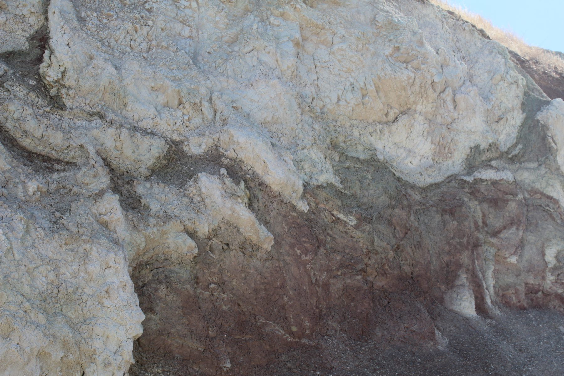
The USGS record for the Ruth is specific: scheelite disseminated in skarn and silicated limestone beds 2 to 6 feet thick near the granite contact, with orebodies localized in fracture zones along small-displacement faults cutting the metasedimentary section. Expected skarn mineralogy is a standard calcium exoskarn assemblage — garnet in the grossular–andradite series, pyroxene in the diopside–hedenbergite series, plus wollastonite, epidote, tremolite–actinolite and calcite. Across 113 Nevada tungsten skarn deposits in the USGS grade-tonnage dataset (OFR 94-005), the geometric mean grade is 0.48% WO₃ — indistinguishable from the historic Ruth grade.
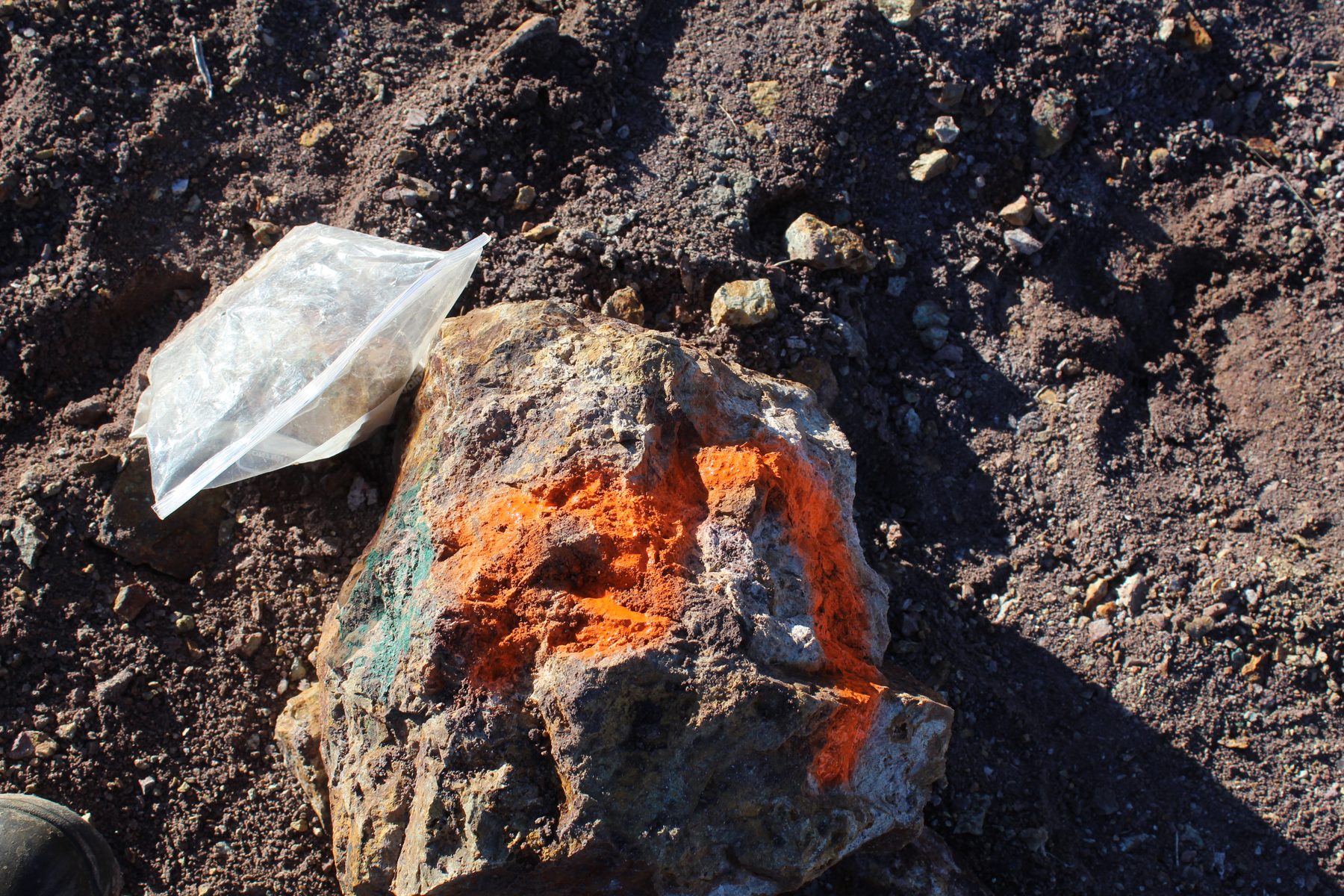
Under shortwave ultraviolet light at 254 nm, scheelite glows bright blue-white, and it does so at grades as low as 0.02% WO₃ — two people with a lamp and a dark night can map the mineralized trace of the contact across this whole block for the cost of a lamp and a weekend. Vivid secondary copper — blue-green azurite, chrysocolla and malachite staining — also turns up in outcrop and dump material across the block. It isn't the target commodity, but it says the mineralizing system was bigger than tungsten alone; the district's Old Soldier prospect 2.75 miles northwest carries a molybdenum–gold–silver–copper signature on the same intrusive contact. No assay has been run on any of the copper material — a gap a first-pass sampling program would close.
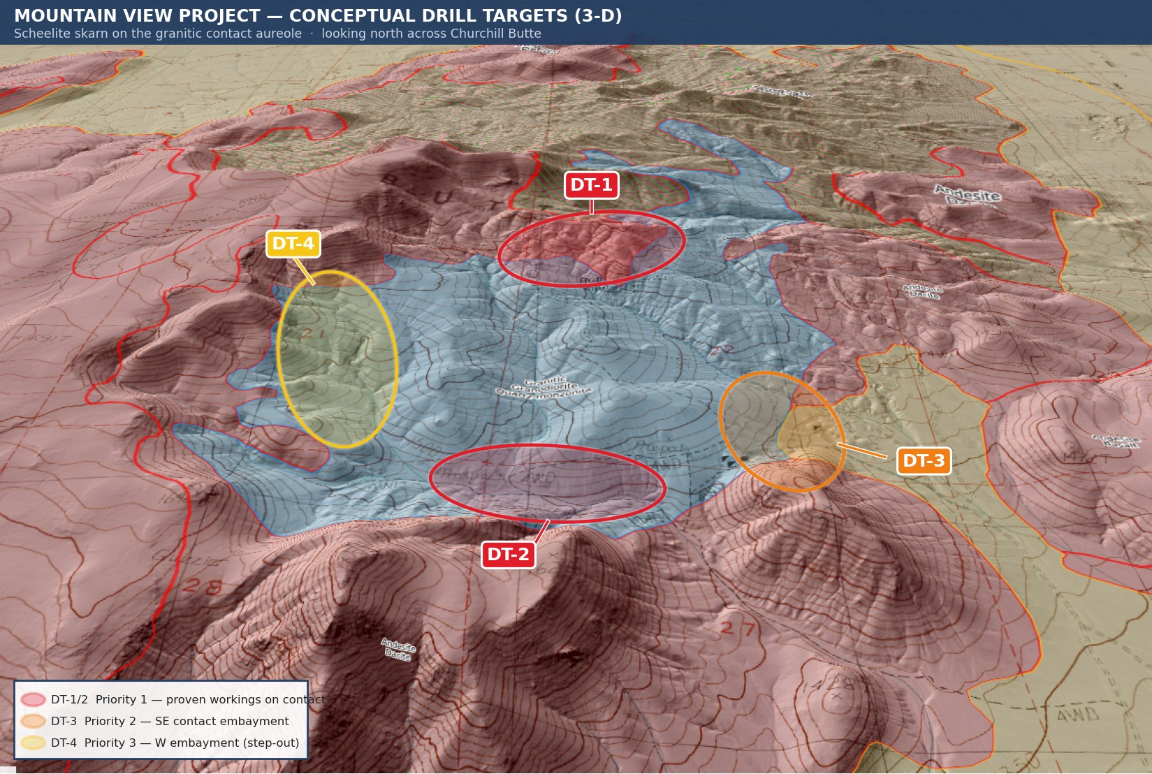
Four conceptual drill targets ring the intrusive contact aureole. These are planning-stage concepts only, subject to ground-truthing by UV mapping, channel sampling, and ground geophysics — no hole has ever been collared on this property.
| DT-1 (Priority 1, drill-ready) | Northern intrusive contact at the Ruth Mine — proven scheelite skarn on the granite contact, testing down-dip and along strike beneath the historic mined block. |
|---|---|
| DT-2 (Priority 1, drill-ready) | Southern contact aureole over Mountain View 2–4, on the arc where USGS prospect symbols cluster — untested by any working, but on the same structure. |
| DT-3 (Priority 2) | Southeast contact embayment near the Mountain View 1 shaft, where the mapped host changes character — wants surface work before drilling. |
| DT-4 (Priority 3) | Western contact embayment, Section 21 — outside the current block; would require staking first. |
Note: no mineral resource or reserve has been estimated for this property. A planning-stage exploration target sketched in the full project report runs from ~160,000 tonnes at 0.45% WO₃ (low case) to ~576,000 tonnes at 0.45% WO₃ (base case) — explicitly labeled speculative, with insufficient geological evidence to support a defined mineral resource. See the full project site for the complete Phase 0–2 exploration budget (~$1.07M, 18 months).
Tungsten has the highest melting point of any industrial metal and is designated a critical mineral by the USGS and a strategic material by the Department of War. China controls roughly 82% of global production, and U.S. primary tungsten mine production has been effectively zero for about a decade. On 4 February 2025, China imposed export licensing controls on tungsten; APT (ammonium paratungstate) exports fell sharply and price followed.
The policy response has moved fast: a March 2025 executive order expedited BLM permitting for critical minerals; tungsten was formally added to the federal Critical Minerals List in November 2025; a January 2026 Section 232 proclamation found the U.S. lacks a secure critical-mineral supply chain; and February 2026 brought Project Vault, a $12B EXIM-backed stockpile that functions as a price floor for domestic producers. Strategic buyers are already transacting on comparable Nevada tungsten skarns — Viking Mines (ASX: VKA) raised roughly A$3.8M to acquire six historic Nevada tungsten projects at a historic grade of 0.54% WO₃, and holds a $191M EXIM letter of interest; Nevada Rand LLC acquired the historic Victory tungsten mine near Gabbs with federal-buyer interest.
Note: price and policy figures above are current as reported on the full project site (market analysis dated May 2026). No tonnage has been defined for this property, so there is nothing yet to multiply a margin by — see the full site for the complete price-history chart, per-tonne economics table, and comparable-transaction detail.
Churchill Butte is a 5,928-foot Basin-and-Range summit east of the Virginia Range, between US-50 and Alternate 95. The claims sit on its southeast flank, in Section 22 of Township 17 North, Range 24 East, Mount Diablo Meridian. Reno is about thirty miles west — roughly forty five minutes — and Silver Springs is eight miles northeast. Fernley, with the Union Pacific mainline and an industrial park, is fifteen kilometres southwest.
| Nearest City | Reno–Sparks, NV — ~50 km (30 mi) west |
|---|---|
| Nearest Town | Silver Springs, NV — 8 mi northeast |
| Rail / Industrial | Fernley, NV — ~15 km southwest (Union Pacific mainline) |
| Power | NV Energy grid ~10–15 km |
| Assay Labs | ALS / Bureau Veritas, Reno — ~50 km, 10–14 day turnaround |
| Airport | Reno–Tahoe International — ~55 km west |
| Groundwater | ~30–50 m depth (regional) |
| Toll Processing | Springer Mine & Mill (APT circuit) — ~180 km southwest |
| Climate | Semi-arid high desert; 125–175 mm annual precipitation, mostly winter snow; summers 25–38°C, winters −10 to +10°C |
All eight claims are unpatented federal lode claims on BLM-administered public land, located under the General Mining Law of 1872. The BLM annual maintenance fee is $200 per claim, due September 1 — $1,600 per year for the full eight-claim block if paid in full. Because the block sits under the ten-claim small-miner threshold, the holder can instead file the Small Miner's Waiver (genuinely free, no service charge) and complete $100 of assessment work per claim per year, filing an Affidavit of Assessment Work or Notice of Intent to Hold by December 30.
| BLM Maintenance Fee | $200/claim/year, due Sept 1 ($1,600/year for 8 claims) |
|---|---|
| Small Miner's Waiver | Free — eligible at 8 claims (10-or-fewer threshold); requires $100/claim assessment work + affidavit by Dec 30 |
| Notice-Level Operations | BLM Nevada, <5 acres disturbance, 15 business days |
| Plan of Operations | BLM, >5 acres disturbance, months to years (NEPA review) |
| Reclamation Bond | NDEP / NDOM, filed concurrent with operations |
Note: fee figures verified against current BLM guidance. Records for this claim block can be searched on MLRS (mlrs.blm.gov), which replaced the retired LR2000 system.
| Type of Claims | Unpatented Lode (8 claims) |
|---|---|
| Total Acreage | ≈140 acres consolidated (154.4 acres digitized; 165-acre legal cap for 8 lode claims) |
| Commodities | Tungsten (scheelite, primary); Copper (secondary, unassayed) |
| State, County | Nevada, Lyon |
| District | Churchill Mining District, Churchill Butte |
| Deposit Type | Contact-metamorphic tungsten skarn (USGS model 14a) |
| Development Status | Past producer (Ruth) + undrilled prospect (Mountain View Group); never drilled as a consolidated block |
| MRDS Records | #10043888 / #10222304 (Ruth); #10246732 (Mountain View Group) |
| Accessibility | Graded road off the US-50 / Alternate 95 corridor, ~45 min from Reno |
A mining claim gives the holder the right to mine on mineral-rich land that belongs to the federal government. Mining claims are a tangible asset and show proof of all interests in the minerals in the area. They can be bought, sold, or used as collateral, just like any other piece of real estate.
A mining claim can be sold, traded, leased, gifted, willed, used as collateral, or transferred in part or in its entirety, just like any other real property, using a quitclaim deed, which is a recordable conveyance. Questions about the transfer process can be answered by contacting us anytime. All current fees and paperwork are paid and kept current through the coming assessment year.
$65,000
Cash Price · 8-Claim Block
Make a one-time payment and get new mineral rights transferred into your name for all eight claims.
Buy Online NowEmail us for more information and additional payment options, including owner-financing. For the complete technical report, drill-target renderings, and market analysis, see the full project site ↗.
After your purchase is complete, you'll be asked to fill out our new claim owner form with your name and address. We handle all the filing and transfer services on your behalf, and you'll receive officially stamped, recorded copies of your paperwork from the Lyon County Recorder's Office and the Nevada State Office of the Bureau of Land Management, officiating you as the new claimant.
Explore more BLM-verified mining claims across the American West.
Every claim currently for sale, sorted by price. Tap a name to open the full listing.
| Claim | Price | Commodity | County / State | Acreage |
|---|---|---|---|---|
| The Virginia Lynn | $1,000,000 | Silver, Gold, Copper +4 | Dolores County, Colorado | 87.64 |
| The Sedona Legend & Sunrise Claims | $71,980 | Gold | Yavapai County, Arizona | 80 |
| Mountain View Tungsten Project you’re here | $65,000 | Tungsten, Copper | Lyon County, Nevada | ~140 |
| Ophy I-V Claims | $41,250 | Gold, Silver, Copper | Boise County, Idaho | 79.35 |
| Sunny Side Up #1-2 | $21,500 | Gold, Silver | Southeast Fairbanks, Alaska | 80 |
| Boulder #2 & #3 | $15,000 | Gold, Silver | Boise County, Idaho | 41.32 |
| The Winna-Winner Claims | $10,000 | Gold, Silver, Iron +2 | Humboldt County, Nevada | 40 |
| Belcher Canyon | $9,997 | Gold | Nye County, Nevada | 20 |
| The Golden Trinity Claim | $8,000 | Gold, Platinum, Silver | Trinity County, California | 20 |
| Marigold #1 | $7,500 | Gold, Silver | Yavapai County, Arizona | 20 |
| Ayers Claim | $6,500 | Gold, Silver | Sierra County, California | 20 |
| The Eureka Comstock Placer | $5,000 | Gold, Copper, Silver | Washoe County, Nevada | 20 |
Prices and availability change as claims sell. Ask about any of these or see what has already sold.